Marknadens största urval
Snabb leverans

Böcker utgivna av Cicerone Press

Filter
Filter
Sortera efterSortera Populära
  • - The best low level walks and challenging mountain routes
    av Paddy Dillon
    245,-

    The 45 walking routes in this Isle of Arran guidebook range from easy 3km (2 miles) nature trails to long arduous mountain routes with scrambles (up to 32km) providing thorough coverage of Arran, including the ascent of Goatfell and nearby Holy Isle. Most routes are 10 to 15km long but many give opportunities to create longer cross-island walks.

  • av Iain Harper
    245,-

    Day walks and 2 short multi-day routes in and around Knoydart in the western Highlands, one of Britain's last true wilderness regions. Covering the Rough Bounds, Morvern, Moidart, Ardgour and Ardnamurchan, the guide features a selection of mountain and coastal routes. Includes ascents of several Munros and Corbetts.

  • av Mike Wells
    245,-

    Guidebook to cycling the Loire, France's longest river, from its source in the Massif Central to the Atlantic. The 1061km route incorporates the popular, waymarked Loire a Velo and takes in extinct volcanos, vineyards and chateaux. Predominantly downhill or flat, the route utilises mostly cycle paths and minor roads.

  • av Iain Harper
    255,-

    This guidebook describes the Cape Wrath Trail, a long-distance trek from Fort William to Cape Wrath crossing the wild northwest of the Scottish Highlands. The route is described from south to north in 14 stages, with 6 alternative stages along the way, allowing for a flexible itinerary of between two and three weeks. A long tough trek with no waymarking, this is for the tried and tested backpacker. The guidebook includes OS mapping, route profiles and detailed route descriptions and gives you all the information you need about accommodation (including hotels, bothies, B&Bs and bunkhouses), campsites and amenities en route, to help you plan and prepare for this epic challenge. The Cape Wrath Trail is regarded as the toughest long-distance route in Britain and offers unparalleled freedom and adventure to the experienced and self-sufficient backpacker prepared to walk for many days in remote wilderness. Travelling through the wild and rugged landscapes of Morar, Knoydart, Torridon and Assynt, it will test the limits of your endurance.

  • av Peter Edwards
    339,-

    Stunning backpacking routes in the Scottish Highlands and Islands are covered in this inspiring, large-format guidebook. 30 routes are described, ranging from 1-4 days, with most suitable for a long weekend. The routes are divided between the Western Highlands and Inner Hebrides, the Central and Eastern Highlands, the Northwest Highlands, the Far North and the Outer Hebrides. They are suitable for those with the experience and self-reliance to navigate proficiently and stay safe in an environment which can easily become inhospitable. Although some routes visit bothies, most call for at least one night's wild camping. Each walk includes overview data, route description and 1:100,000 mapping and they are illustrated with stunning photos. An introduction offers background information about the Highlands' rich geology, plants and wildlife and the historical and cultural context of Scotland's 'wilderness'. There is also practical information on preparing for an incursion and advice for those looking to expand their experience of wild-country backpacking. The Highlands and Islands of Scotland are home to the most ruggedly beautiful, expansive and challenging backpacking country in the British Isles. This is a land for those who love open spaces, vast horizons, and the domination of nature.

  • av Steve Kew
    209,-

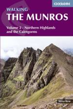
    This guidebook is volume 2 of a two-part set, detailing 70 routes to 144 Munros in the Cairngorms and Northern Highlands (north of the Great Glen). It includes all the popular routes, in areas such as Knoydart, Torridon and on Skye. The guide is ideal for Munro bagging, or for guidance on walking such hills as Ben Macdui, Cairn Gorm, The Angel's Peak, Craig Meagaidh and the Cuillin on Skye. All routes prefaced by a wealth of information about Gaelic names, accommodation and access; useful 10-figure grid refererences for key points such as summits and start point of awkward descent lines; travel and other information on making the most of your walks and your stay in the area. As well as a thorough introduction covering, transport and accommodation, each route includes information on distance, ascent, and route time; as well as detailed descriptions of the walk. Volume 1 covers the Munros of the southern, central and western Scottish highlands.

  • av Giles Belbin
    245,-

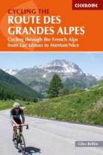
    Abounding in history and dotted with cols coloured by stories about the world's greatest cyclists, the Route des Grandes Alpes (RdGA) is a must for competent, hill-hungry cycle tourers. Covering some 720km from Lake Geneva (Lac Leman) to mediterranean Nice, the route is described across 14 stages and can be completed in anywhere from 7 to 14 days - depending on how you'd like to spread out the 17,000m of climbing. Six variants are also described, ensuring no holiday is compromised or cut short if a col on route is closed. Clear and concise route descriptions are provided for each stage (and variant), together with 1:150K mapping and extremely helpful gradient profiles. Also included is invaluable practical adviseeverything from bicycle selection (including eBikes) and nutrition in the saddle, to logistical planning and accommodation options. Showcasing some of the world's best Alpine cycling, the RdGA takes in 17 major climbs, including the famous Col de l'Iseran (the highest paved pass in the Alps), the Col du Galibier (favourite climb of Tour de France founder, Henri Desgrange) and the Col d'Izoard (synonymous with cycling legends Fausto Coppi and Louison Bobet). It also passes through some of the most spectacular national parks in France, including the Vanoise, the crins and the Mercantour.

  • av Paddy Dillon
    255,-

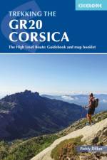
    This guidebook describes the classic GR20 trek, a north-to-south traverse of the rugged mountains of Corsica, renowned as Europe's toughest GR long-distance route. Described in 16 stages, some with high and low-level alternatives, the route is roughly 190km in length and takes approximately two weeks to complete. The GR20 climbs high into the mountains. It is a demanding trek suitable only for experienced walkers, and there are several steep 'hands-on-rock' sections calling for a sure foot and a good head for heights. It is possible to stay under a roof every night but many trekkers opt to camp. Step-by-step descriptions of each stage are accompanied by 1:50,000 mapping, together with information on ascent/descent, terrain and the availability of food, water and accommodation/shelter. There is also invaluable practical information such as path conditions, what to take, and getting to/from and around Corsica. Overviews of the history and geology of the island and local plants and wildlife are offered to enhance the trekking experience. Finally, a separate map booklet, included with the guide, provides all the 1:25,000 IGN mapping needed to complete the GR20. Starting in Corsica's northwest, in picturesque Calinzana, the route winds southeast through the heart of the island, finishing on the eastern side, just north of Porto Vecchio in the township of Conca. It showcases Corsica's rich diversity of landscapes and ethereal beauty. Bare rock and sheer cliffs contrast with black sand beaches, alpine pastures, maquis and pockets of forest. There are also opportunities to detour from the route to visit traditional mountain towns and villages for a taste of Corsica's vibrant history and culture and to take in neighbouring summits, including the island's highest peak, Monte Cinto. For those up to the challenge of hiking part or all of the route, the GR20 promises adventure, memorable experiences and rich rewards.

  • av Andy Davies
    209,-

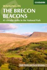
    Guidebook to 45 graded circular walks in the Brecon Beacons National Park, perfect for those wishing to discover the diversity of the region, away from the crowds. The routes range from 4 to 24km and cover the north-eastern, eastern and south-western valleys and ridges, Fforest Fawr, Waterfall Country, the Black Mountain (Mynydd Du) and the Black Mountains (y Mynyddoedd Duon). Designed to include all the interesting facts an expert park ranger would provide, the guide contains a wealth of information about local geology, botany, archaeology, history, mythology, industrial heritage and environmental issues. Clear route description is illustrated with 1:50,000 OS Landranger mapping, summary statistics are provided for each walk and handy tables make it easy to compare routes or choose according to points of interest. A useful Welsh-English glossary is also included to help you make sense of local place-names. A remarkably varied landscape, the Brecon Beacons National Park showcases some of the best scenery in Wales. The walks take in mountain peaks and ridges, waterfalls, wooded river gorges and remote upland valleys, with highlights including Pen y Fan, the highest peak in south Wales, and the spectacular Sgwd Gwladus (White Lady Falls), Sgwd yr Eira and Sgwd Clun-gwyn waterfalls. Picturesque market towns on the edges of the park, such as Llandovery, Brecon, Crickhowell and Abergavenny, are also great places to explore and ideal bases for a walking holiday.

  • av Paddy Dillon
    255,-

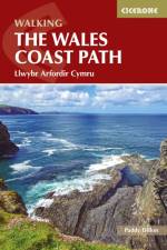
    The Wales Coast Path offers an unparalleled opportunity to walk a nation's coastline in its entirety. Stretching 1400km (870 miles) from Chester to Chepstow, including Anglesey, the waymarked trail takes 2-3 months to complete but can easily be broken into shorter sections. The walking is generally not difficult, although there are occasional rugged sections, steep ascents and descents and more remote stretches with fewer facilities. Promising fantastic scenery and a unique insight into local history and culture, what better way to experience the diversity and beauty of Wales' captivating coastline?The route is presented in 57 stages, ranging from 16 to 32km, each featuring clear route description illustrated with 1:100,000 mapping, overview statistics and notes on the availability of accommodation, facilities and public transport links. You'll find plenty of helpful advice for planning your walk, plus background information on Welsh history, geology, plants, wildlife and local points of interest. A facilities table, Welsh glossary and useful contacts can be found in the appendices. Passing through the Snowdonia and Pembrokeshire Coast National Parks, as well as numerous AONBs and sections of Heritage Coast, the Wales Coast Path takes in seaside resorts, attractive fishing villages, sandy beaches, rocky coves and striking cliff coastline. Highlights include the picturesque Llyn and Gower peninsulas, 13th-century 'Iron Ring' castles and frequent opportunities for wildlife spotting. The route can be linked with Offa's Dyke Path National Trail (covered in a separate Cicerone guide) to complete a full circuit of Wales.

  • av Steve Davison
    179,-

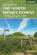
    Guidebook to 30 circular day walks in the North Wessex Downs Area of Outstanding Natural Beauty (AONB). The routes, which range from 4 to 13 miles long take in parts of four counties - Berkshire, Hampshire, Wiltshire and Oxfordshire. The walks allow you to explore parts of the Ridgeway National Trail, the Kennet and Avon Canal and stunning historic sites, such as Avebury, the 3000-year-old Uffington White Horse, impressive Neolithic long barrows and Iron Age hill forts. The North Wessex Downs are accessible hills that rise above the towns and rural plains of southern England and roll gently west from Reading and Basingstoke to Swindon and down past Marlborough to Andover. Alongside detailed route descriptions and OS maps, are plenty of details on points of interest, as well as practical information on the area from public transport links, to ideal refreshment stops on each walk. The result is an ideal companion to exploring both the popular and untouched corners of the North Wessex Downs.

  • av Vivienne Crow
    279,-

    King of the Fells. Iron man. Lake District fell running legend. Joss Naylor is all of these things and more. His achievements are astounding, his records stand the test of time. In 1983 he completed the 105-mile Lakes, Meres and Waters (LMW) route in a staggering 19hr 14min and to this day, describes it as one of the best routes he ever ran. High praise indeed and yet, so few know of it. Part guidebook, part inspirational regaling, this book interweaves tales of past and present as Naylor reflects on his 1983 epic on a re-walk 37 years later. In the company of award-winning author, Vivienne Crow, Naylor recalls that magical day, sharing stories and anecdotes from, not just his run, but the 1980s fell running scene, his working life and growing up in the Wasdale Valley. Naylor's tales, together with breathtaking photography, are accompanied by basic guide notes for the LMW route, sticking as closely to his 1983 run as possible. These notes divide the route into ten stages (ranging from 9 to 14 miles), allowing runners and walkers to follow in the footsteps of the King of the Fells, albeit on a more relaxed schedule. From Loweswater to Over Water, visiting 27 of the Lake District's largest bodies of water, the LMW route guarantees vistas of unparalleled beauty and an unforgettable experience in true fell country.

  • - 24 Routes and the Jersey Coastal Walk
    av Paddy Dillon
    184,99

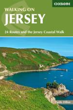
    Guidebook describing 24 day walks on Jersey in the Channel Isles. Parts of many routes can be combined to make longer routes, including the 48 mile Jersey Coastal Walk and part of the Channel Islands Way. Walks are between 3 and 8 miles, mainly on good paths and tracks, although occasionally rugged cliff paths explore the beautiful coastline.

  • av Steve Kew
    245,-

    This guidebook presents 69 challenging and inspiring routes to climb 139 Munro mountains, including Scotland's highest peak, Ben Nevis. Part of a two-part set, this first volume covers the southern, central and western Highlands (south of the Great Glen), taking in stunning areas such as Glen Coe, Glen Shee, Lochaber and Mull. Covering popular and lesser-known routes, it is ideal both for Munro-baggers and those who simply love great mountain walking, and is a convenient size for slipping in a rucksack. The half-day and full-day walks and scrambles range from 7km to 48km (with the option to reduce walking distance on some of the longer routes by cycling the approach). Detailed route description and 1:100,000 mapping is accompanied by information on difficulty, mapping, parking, access and nearby accommodation. The guide also includes handy lists of Munros, by height and alphabetically - perfect for peak-baggers - as well as useful details on Gaelic names. Including the iconic Ben Nevis, Buachaille Etive Mr and Aonach Eagach ridge as well as the Mamores, Grey Corries and Arrochar Alps, Walking the Munros volume 1 is an ideal companion to conquering the Munros and discovering the magnificent mountain landscapes of the southern Highlands. Volume 2 details the other 143 Munros, covering the northern Highlands, Cairngorms and Isle of Skye.

  • av Paul Besley
    175,-

    This guidebook is the ideal companion for walkers who want to explore the western section of Derbyshire's White Peak area. Starting in towns and villages including Castleton, Ilam, Buxton, Tideswell, Hartington and Longnor, these day walks are perfectly suited for year-round trips to the Peak District and are suitable for walkers of all abilities. Across 40 day walks, this guidebook offers a range of routes that showcase the best of the Peak District landscape: rolling green hills rising up to limestone ridges, deep dales with meandering rivers, and limestone caves and pinnacles. There is plenty of history to explore too, with many walks visiting historical sites from Neolithic, medieval and industrial periods. Most of the walks range between 4 and 9 miles and can be enjoyed in 2-4 hours walking. As several start from the same car park or village, many walks can be combined for longer days out. Each walk features clear OS mapping and detailed route description interspersed with insights into the area's history, geology, art and culture, making this a brilliant guide for both navigation and learning about the Peak District.

  • av Terry Marsh
    119,-

    Map of the 79 mile (127km) Dales Way through the Yorkshire Dales between Ilkley and Bowness-on-Windermere. This booklet is included with the Cicerone guidebook and shows the full route on OS 1:25,000 maps. One of the most gentle multi-day walks in Britain, it passes through Grassington, Kettlewell, Dent, Sedbergh and Staveley.

  • av Ronald Turnbull
    209,-

    The south-eastern Grampians of the former county of Perthshire may be grassier and less rugged than other Scottish mountains, but they are just as big. The routes in this guide take you to the summits of these 'jolly green giants' - covering all of the region's Munros, often by unconventional routes, as well as several Corbetts and smaller hills - and also over the Atholl passes, along rivers and through the woods of Perthshire's 'Big Tree Country'. The 80 walks comprise a mixture of low-level, mid-level and mountain routes and are graded by both length and difficulty. Many are demanding, crossing remote, uneven, steep and/or pathless terrain, but also included are gentler walks on clear paths taking in local features of interest. The route description is illustrated with clear mapping (a mixture of OS 1:50,000 and smaller-scale maps for the longer routes) and the route summary table and grading information make it easy to choose an appropriate route. There is a wealth of information about the landscape and the region's fascinating history. Finally, appendices cover local facilities and access to the hills during the deer-stalking season. With highlights including the mighty Ben Lawers, Beinn Dorain, Ben Alder and Beinn a' Ghlo; Schiehallion; the great rivers Tay and Garry; the Birks of Aberfeldy; and old drovers' routes over the passes of Minigaig and Gaick, Perthshire has plenty to offer. And with historic towns, such as Perth and Pitlochry, and attractive villages, this is an ideal base for a walking holiday.

  • av Terry Marsh
    245,-

    A fully waymarked trail from Ilkley to Bowness-on-Windermere, the Dales Way links two of England's most celebrated national parks, the Yorkshire Dales and the Lake District. Well served for accommodation and facilities, and with easy walking on riverside paths, it is one of the gentlest multi-day walks in Britain and therefore an ideal introduction to long-distance walking. It can be comfortably completed in 6-8 days. The guide offers comprehensive notes on local points of interest, as well as an overview of Dales geology, history, plants and wildlife to enhance the walking experience. The practical information is all there too, including when to go, how to get there and what to take, making for an ideal companion to enjoying this delightful route. Presented in six daily stages of 7-19 miles (with suggestions for alternative schedules), this guide describes the Way in both directions, with the main route description running from south to north. Step-by-step route description is accompanied by 1:100,000 mapping, and a trek planner, showing where facilities are available, is included to facilitate planning. Accommodation listings and useful contacts can be found in the appendices. A separate, conveniently sized map booklet located in the back-cover sleeve provides all the OS 1:25,000 mapping needed to complete the trail.

  • - 11 walks and 4 boat trips exploring the best of the islands
    av Paddy Dillon
    135,-

    This guidebook to walking on the Scilly Isles includes 11 day walks and 4 boat trips, perfect for a fortnight away from it all. The walks are between 1.5 and 10 miles long (2.5km and 16km), and explore the larger islands such as Tresco, St Martin's, St Mary's, St Agnes and Bryher as well as smaller islands in the archipelago. All routes are illustrated with OS mapping and contain lots of background information on the history, geology and ecology of the islands. There is also practical information on public transport services and accommodation. Alongside the walks, which are suitable for walkers of all abilities, are 4 boat trips which explore Annet and the Western Rocks, the Norrard Rocks, St Helens and Tean as well as the Eastern Isles. With their mild climate and relaxing atmosphere, the Isles make an ideal holiday destination, with stunning scenery, rich bird life and myriad wildflowers. Basking in sunshine, rising green and pleasant from the blue Atlantic Ocean, fringed by rugged cliffs and sandy beaches, they reveal their charms to those who walk the headlands, sail from island to island and take time to observe the sights, sounds and scents of the landscape.

  • av Rachel Crolla
    165,-

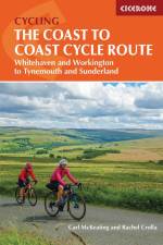
    As the wildest of the northern coast-to-coast cycle routes, the Reivers Route explores the rich Border Reiving history of northern England and the Scottish Borders. Travelling 173 mile (280km) from Whitehaven to Tynemouth, this four-day cycle tour takes in the Cumbrian coast, northern Lake District, Northumberland National Park and North Tynedale, offering memorable off-road cycling through Kershope Forest and around Kielder Water. The route offers both on and off-road cycling, and is suitable for cyclists using touring or hybrid bikes. Places to stay overnight include Carlisle, Bailey Mill and Bellingham. The guidebook also offers the Borderers Ride, an alternative coast-to-coast ride along the England-Scotland border from Gretna to Berwick-upon-Tweed. This route joins up the fantastic middle section of the Reivers Route with a route heading north via Wooler and the Holy Island of Lindisfarne to finish at Berwick-upon-Tweed. Whether on the Reivers Route or the Borderers Ride, these cycle tours offer exceptional cycling on gated roads and quiet cycle paths as they explore rolling hillsides, remote forests and plenty of historic sites. This guidebook provides everything you need to enjoy a successful cycle tour on the Reivers Route or Borderers Ride. Each stage includes detailed 1:100,000 mapping, profiles and comprehensive route description containing insights into points of interest along the way. The introduction offers plenty of information about the area's history, as well as practical advice about suitable bikes, equipment, and transport to and from the route. The appendices feature useful contacts for bike shops and available accommodation.

  • av Mark Sutcliffe
    179,-

    Offering 40 day walks in Lancashire, this guidebook explores the often-overlooked regions of Forest of Bowland, Ribble Valley and West Pennine Moors. With walks ranging from low-level valley trails to higher hill routes, this guidebook offers plenty of year-round walking options for active families and committed hikers alike. The walks are accessible from a range of nearby villages, towns and cities including Preston, Blackburn, Burnley, Chorley, Lancaster and Clitheroe. Lancashire showcases some of the most varied walking in the UK, featuring the wide expanse of Morecambe Bay, the Forest of Bowland AONB and limestone fringes of the Yorkshire Dales. These walks travel along green valleys, gritstone moors and untamed hillsides to explore remnants of Lancashire's rich history: The War of the Roses, the Pendle witch trials and the industrial heritage of the West Pennine Moors. Providing detailed route description and clear OS mapping for all 40 walks, this guidebook includes an introduction full of information about the area including accommodation, transport and access. The appendices contain a route summary table to help you plan your days out, while each walk offers notes on wildlife, history, geology and available refreshments.

  • av John Fleetwood
    265,-

    Guide to 100 scrambling routes in the north of the English Lake District, covering Wasdale, Ennerdale, Buttermere, Borrowdale, Blencathra and Thirlmere. It presents a comprehensive collection of scrambles on crags and gills, which are linked together to form 25 first-class mountain days. The carefully graded routes range from scrambling grade 1 to climbing grade V Diff, so there is something for beginners as well as veteran mountaineers. Rock climbing equipment is needed for more difficult routes. Each scramble is described with notes about grade, quality, aspect and approach, with colour maps and topos to aid navigation. There is information on safety and equipment, and listings of scrambles by location and grade to allow the reader to assemble their own tailor-made combination of routes. The Lake District is one of the most scenic areas in the world and this guide includes popular routes such as Sharp Edge, Cam Crag Ridge and Sphinx Ridge, dramatic gills like Sandbed and Ill Gills, and 28 classic rock climbs including Corvus, Needle Ridge, Grey Knotts Face and Steeple's East Buttress.

  • av Richard Barrett
    245,-

    A concise guide to cycling LEJOG - Land's End to John o' Groats - describing an idyllic route that follows quieter roads and traffic-free paths but without too much meandering. Covering 1000 miles, the route is divided into 14 stages and can be comfortably ridden in two weeks. Easy-to-follow route descriptions are accompanied by clear mapping and useful gradient profiles, together with route highlights and points of interest, of which there are many. Invaluable tips and tricks are also included from preparing yourself to preparing your bike, together with logistical advice such as getting to and from the start and finish, accommodation options and more. In addition to the main 14-stage schedule (which includes an alternative option through Central Scotland), longer and shorter schedules are also suggested, making it easy to prepare a personally tailored adventure. The route, which passes through a diverse range of landscapes, from almost sea level across the Somerset Levels to over 1400ft through the magnificent Cairngorm Mountains, showcases some of Britain's best cycling. It is a must for anyone who's ever been remotely tempted to take on this iconic end-to-end challenge.

  • av Guy Hunter-Watts
    265,-

    The GR7 is one of Europe's longest GR long-distance routes, stretching from Tarifa, the southernmost town of continental Europe, through Spain, Andorra and France to Alsace. This guide presents the Andalucian section of the route, which offers well over 700km of fantastic walking through the diverse landscapes of one of Spain's most evocative regions. The route splits at the small village of Villanueva de Cauche, and the guide describes both the northern and southern variants. Although walking is on good footpaths, country tracks and, occasionally, minor roads, some of the stages are long and can involve considerable ascent, meaning that a good level of fitness is required. The full Andalucian GR7 takes well over a month to walk; however, the guide also includes suggestions for highlight sections that can be walked in a week or fortnight. In addition to clear route description, mapping and elevation profiles, the guide provides background information on local history, plants and wildlife, and advice for planning your trip, such as when to go, what to take and where to stay. The route showcases Andalucia's rich history and culture and varied landscapes, which include pine forests, semi-arid desert, snow-capped peaks, fertile plains, lush valleys, olive groves, cultivated terraces and hills of cork woodland. Historic towns and traditional whitewashed villages offer overnight accommodation and a chance to sample local cuisine.

  • av John Hayes
    335,-

    This guidebook to cycling the Ruta Via de la Plata through western Spain describes the 930km route from Seville to the coastal city of Gijon in around 2 weeks (14 stages). A pilgrimage variant, the Camino Sanabres, to Santiago de Compostela is also described (16 stages in total). Empty roads and gentle climbs make the route accessible to a wide range of bikes and cyclists. Both road and off-road versions are presented, and the guide shows how they can be combined to create a perfect touring, hybrid or gravel cycling trip. The guide includes leg-by-leg route descriptions, 1:150,0000 colour mapping, elevation profiles and helpful ride planners to show where riders can swop from the off-road to the road route. There is advice on equipment, travel and transporting your bike, alongside a list of accommodation contacts and a useful Spanish glossary. The Ruta Via de la Plata is one of Spain's most important pilgrim routes. The 2-week journey takes in 7 UNESCO world heritage sites (Seville, Mrida, Cceres, Salamanca, Leon, Zamora, and Oviedo) with the famous pilgrimage site of Santiago de Compostela if the Camino Sanabrs is taken. There is lots of good-value accommodation available, from hostels to palaces, and plenty of chances to sample Spanish gastronomy.

  • av Andrew McCloy
    289,-

    At around 4500km (2800 miles), the England Coast Path is the longest coastal trail in the world. This inspirational large-format guide presents a handpicked selection of 30 highlight sections, offering a taste of England's stunning and diverse shoreline. Routes range from 9 to 45km, spanning between 3 hours and 2 days, offering options to suit all abilities. They can be accessed by public transport and are walkable year round (weather permitting!). Route descriptions are accompanied by 1:50,000 OS map extracts. Included in each walk are comprehensive listings of public transport, toilets and places to eat and drink, which highlight the excellent walking infrastructure available in many areas. Overview information on terrain, distance and timing facilitates easy planning, a route summary table helps you to choose an appropriate route, and there are also GPX files available for free download. Fascinating snippets of history and geology are interspersed throughout, and the appendices contain useful websites and further reading. Incorporating beautiful photography of England's coastline, the guide will encourage you to explore both well-loved and less well-known parts of the English shoreline, from soaring cliffs to wildlife-rich estuaries, from huge golden beaches to atmospheric marshes. Capturing the rich heritage and glorious contrasts of England's coast, the routes offer something for everyone, whether your passion is for escape or adventure, geology or nature, castles or culture. The sea has defined England's history and the coast is a dynamic and exciting place to walk, so let these 30 routes introduce you to great walking by the sea on England's newest National Trail.

  • av John Fleetwood
    265,-

    Guide to 106 scrambling routes in the south of the English Lake District, covering Langdale, Coniston, Eskdale, Patterdale & High Street. A comprehensive collection of scrambles on crags and gills, which are linked together to form 24 first-class mountain days. The carefully graded routes range from scrambling grade 1 to climbing grade V Diff, so there is something for beginners as well as veteran mountaineers. Rock climbing equipment is needed for more difficult routes. Each scramble is clearly described with notes about grade, quality, aspect and approach, with colour maps and topos to aid navigation. There is information on safety and equipment, and listings of scrambles by location and grade allow the reader to assemble their own tailor-made combination of routes. The Lake District is one of the most scenic areas in the world and this guide offers new routes in previously unexplored corners of the region alongside popular classics such as Jack's Rake, Esk Gorge and Pinnacle Ridge, as well as dramatic gills like Dungeon and Linkcove Gill. 10 classic rock climbs are also presented including Giant's Crawl, Middlefell Buttress and Crescent Climb.

  • av Rudolf Abraham
    245,-

    Guidebook of 30 stunning day walks in the beautiful Salzkammergut lake district of Austria. Easy to get to from Linz and Salzburg, the area is studded with lakes and bristling with mountain peaks, and has a great range of waymarked trails, from lakeside strolls to challenging mountain walks. The routes in this book are within the capabilities of any reasonably fit walker, many are suitable for family hiking, and cablecars and lifts can often be used to make walks shorter or easier. Walks range from 6 to 16km and a simple grading system makes it easy to choose the right one. Walks are centred around a number of bases, such as Bad Ischl, Fuschl am See, St Gilgen, Ebensee, Bad Aussee, Gl, and Hallstatt, and explore the mountains of the famous Dachstein and Totes Gebirge, and many of the area's beautiful lakes, including the Fuschlsee, Mondsee and Traunsee.

  • - Skiddaw, Blencathra and the North
    av Mark Richards
    245,-

    Part of the Walking the Lake District Fells series, this guidebook covers a wide range of routes to 30 Lakeland summits that can be climbed from Keswick, Whinlatter, Bassenthwaite, Caldbeck, Mungrisdale and Threlkeld, with highlights including Skiddaw and Blencathra. Includes suggestions for longer ridge routes.

  • av Luke Smith
    245,-

    Two of the southernmost departements of France, the Pyrenees-Orientales and Ariege are inextricably linked with the history of the Cathars, a heretical Christian sect who were subjected to a crusade in the thirteenth century. Striking castles built on jagged rocky precipices are a highlight of the region and a reminder of those turbulent times. This guidebook describes the 260km Cathar Way (Sentier Cathare or GR367), a long-distance trail from Port-la-Nouvelle on the Mediterranean coast to Ariege's departmental capital Foix linking several of the impressive Cathar castles. The route follows ancient footpaths, jeep tracks and country lanes and calls for a moderate level of fitness as it sweeps from sea level to 1300m across the rugged hill ranges of the Corbieres and Fenouilledes. The guide describes the main route in 13 stages and also includes the slightly more direct north variant, as well as suggestions for shorter itineraries. Summary statistics introduce each day's walking and are followed by step-by-step route description illustrated with clear mapping. There are also details of facilities available en route and accommodation listings. An introduction covers all the practicalities, with comprehensive advice for planning your trip - including when to go, how to get there and what to take - in addition to a wealth of information about the region's fascinating history and the intriguing Cathars themselves. The trail traverses rocky hills and meanders through woodland, vineyards, ancient villages, gorges and plateaus. As well as the rich Cathar heritage, there are also historic wine-producing towns, sites associated with the French Resistance of WWII and mysterious places steeped in ancient legend. The guide is a perfect companion to discovering the Cathar Way and the captivating stories of this distinctive region.

Gör som tusentals andra bokälskare

Prenumerera på vårt nyhetsbrev för att få fantastiska erbjudanden och inspiration för din nästa läsning.