Marknadens största urval
Snabb leverans

Böcker utgivna av Cicerone Press

Filter
Filter
Sortera efterSortera Populära
  • - 1:25,000 OS Route Mapping
     
    164,-

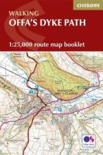
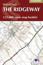
    Map of the 177 mile (283km) Offa's Dyke Path National Trail, between Sedbury (near Chepstow) and Prestatyn. The trail takes 2 weeks to walk, and is suitable for walkers at all levels of experience. This compact booklet of OS 1:25,000 maps shows the full route, providing all of the mapping you need, and is included with the guidebook.

  • - National Trail following the English-Welsh Border
    av Mike Dunn
    255,-

    This guidebook - which includes both a guide to the route and a separate OS map booklet - describes Offa's Dyke Path National Trail from south to north, following the longest linear earthwork in Britain, running 177 miles along the English-Welsh border between Sedbury (near Chepstow) and Prestatyn on the north Wales Coast. The book splits one of Britain's classic trails into 12 stages suitable for walkers of all abilities. Step-by-step route descriptions are accompanied by 1:100,000 OS map extracts. Also included with this guidebook is a booklet of 1:25,000 OS maps, which provides all the mapping needed to complete the trail in a compact form. A trek planner gives at a glance information about facilities, public transport and accommodation available along the route. The walk is astonishingly varied, taking in the lower Wye gorge, the Severn and the Dee rift valley, the pastures and woodlands of the border country, the remote moorland of the Black Mountains and the Clwydian range, and the dramatic limestone escarpments of Eglwyseg mountain. What makes it even more special is over 60 miles walking alongside the Saxon earthwork of Offa's Dyke.

  • av Kev Reynolds
    179 - 195,-

    Guidebook to 40 day walks in the South Downs National Park. The walks, which are designed to suit all abilities, are dotted all over the National Park and range from 4 miles (7.5km) to 11 miles (17.5km). Each walk is circular, and where possible begins and ends at a place accessible by public transport. With some of the most iconic landscapes in southern England, including the white chalk cliffs of Beachy Head and the Seven Sisters, and such well-loved landmarks as Ditchling Beacon and atmospheric ancient monuments like the Cissbury Ring, walking in the park proves a delightful experience mile after mile. Step-by-step route descriptions are accompanied by 1:50,000 OS mapping. Also included is information on the plants and wildlife of the Downs, as well as handy practical tips on accommodation, car parking and public transport.

  • av Phoebe Smith
    189,-

    An introduction to some of the best bothies in the UK. Featuring 26 selected bothies, the author shares her memories of using these free 'stone tents' in some of the country's wildest and most remote locations. Alongside notes on legends and landscape, wildlife and history, the book is full of expert guidance and tips on how to make use of bothies, from packing lists to bothy etiquette and the best walking routes in. Inspiring and fun, the book showcases bothies in Snowdonia, the Brecon Beacons, Lake District, Pennines, the Highlands and Islands of Scotland, and Northumberland, and is a personal celebration of the world of bothying. Hidden away in the hills and mountains of England, Scotland and Wales - for years known only to a lucky few - is a network of huts, cottages and shelters. Completely free to use, these secretive refuges can be life-savers, quick stops and destinations in themselves. The network of British bothies is cared for by the Mountain Bothies Association, and day-to-day by the walkers, climbers and mountain lovers who rest there.

  • - 19 Long-Distance Routes through England, Scotland and Wales
    av Paddy Dillon
    279,-

    Inspirational guidebook to Britain's National Trails - 19 long-distance walking routes through England, Wales and Scotland. Together, these routes (National Trails in England and Wales and Scotland's Great Trails) cover well over 3100 miles (5000km), exploring the rich scenic and historic countryside of Britain. This larger-format guide explores the full breadth of the network, including the popular South West Coast Path, Hadrian's Wall Path, West Highland Way, Cotswold Way, Offa's Dyke Path, South Downs Way, Southern Upland Way and many others exploring the beauty and wild country of the British Isles. Outline schedules for each Trail allow you compare the routes and become inspired to take up the challenge, whether on a relatively short or easy trail, or to tackle a longer, more strenuous route. Basic day-by-day route descriptions for each Trail are illustrated with maps and profiles. Information is provided on access to and from the routes, maps, public transport, guidebooks, TICs, accommodation and useful websites.

  • - Graded routes on cycle-friendly roads in Cornwall, Devon, Somerset and Avon and Dorset
    av Colin Dennis
    179,-

    This guidebook explores 20 sportive cycling routes in the best cycling areas of south west England. Ideal for training, the rides range between 59 and 119km (36 to 74 miles) in length, and offer a full range of challenges; from long, fast flat routes, perfect for pacing, to tough hill climbs on the Downs and Moors of the south west. The 20 sportive routes are found in Cornwall, Devon, Dorset, Somerset, Wiltshire and Gloucestershire, as far north and east as the Wye Valley and Swindon. The range ensures that there is plenty of riding to be found, throughout the region, not to mention the companion Sportives guidebook to routes in England's south east. From the Cotswolds, to Dartmoor, Exmoor, Bodmin Moor, into Wales and the south coast, there are miles of of cycle-friendly roads suitable for sportive training. All 20 routes are graded for difficulty and include timings, ascent, food-stops and access information, as well as annotated route maps and clear route descriptions. Sportive cycling is a growing sport, and this guide provides routes for experienced riders and those new to this sport. Useful information on bike maintenance and equipment, to travelling around the areas with your bike and advice on accommodation is also included. The result is a sportive guidebook that will prepare you for the challenges ahead, and allow you to explore the best cycling the south-west has to offer.

  • - Graded routes on cycle-friendly roads between Kent, Oxford and the New Forest
    av Colin Dennis
    179,-

    This guidebook offers 20 sportive routes in the most challenging and scenic cycling areas of south east England. From the Surrey and Chiltern Hills to the New Forest and Berkshire Downs, the area boasts miles of cycle-friendly roads suitable for sportive training. The graded routes are all on quiet country roads and can be mixed and matched.

  • - From the source to the Rhine at Koblenz
    av Mike Wells
    209,-

    This guidebook provides 14 stages of route description to cycling along the Moselle river, a route that offers stunning scenery, plentiful accommodation and places to eat and drink, and straightforward cycling throughout. A well-waymarked, generally downhill 512km route, it is mostly off-road and on well-surfaced cycle tracks (mainly asphalt) with virtually no gradients, and the majority is along the riverbank or on canal towpaths. From its source in the Vosges Mountains of eastern France, the Moselle flows through the French region of Lorraine and crosses into Luxembourg then into the German Rheinland region before it reaches its confluence with the Rhine at the west German city of Koblenz. Suitable for both veteran long-distance cyclists and for newcomers to cycle touring who wish to start with an easy-to-follow journey, the route can be completed in a week by fit cyclists, cycling two stages per day. Two weeks allow for alternative stages and optional excursions through the Saar and Rhine gorges and to visit the Boucles de Moselle and the city of Luxembourg, and give enough time for sightseeing and a leisurely riding pace.

  • - 44 best hill days in southern Scotland
    av Ronald Turnbull
    195,-

    This guidebook describes 44 routes and over 100 summits across the Southern Uplands of Scotland, stretching south-west from Edinburgh to the English border, including the Galloway and Pentland Hills. The walks range between 2 and 29km, suitable for walkers of all abilities. The Scottish Southern Uplands is a range that is about as big as the English Pennines. It is wild hill country, with over 80 hills of 2000ft or more, and it boasts a real remoteness that is difficult to find elsewhere. All hillwalkers should experience these wonderfully characterful landscapes: green and gentle, but with hidden surprises and remote escapes. The routes are suitable from spring to autumn, and on winter days with good weather and snow conditions. Each route provides OS mapping, information on distance, ascent, time, maximum altitude and terrain, as well as details of any variants or shortcuts. With notes on points of interest along the way as well as on transport and accommodation, the guide gives all the information walkers need.

  • - Tales of Trekking in Nepal
    av Kev Reynolds
    279,-

    On eight treks in Nepal's Himalaya; to Kanchenjunga, Manaslu, Annapurna, Everest, Langtang, Dolpo, Api and Mugu, the true spirit of trekking is captured in Kev Reynolds' reverence, curiosity and ongoing love of the world's greatest mountain range. The Himalaya are no ordinary mountains. Stretching through five countries and dwarfing all others, they have captured the imaginations of travellers and mountain lovers for centuries. While some seek to reach their snowy heights, many more step out onto winding and climbing trails to trek through the heart of the mountains, and live - if only for a little while - the life of an adventurer. The first time a trail is explored offers unknown beauty and fresh experience around every turn. This is Kev Reynolds' collection of eight such discoveries along popular trails and into lands previously locked away. Brought to life in vivid style, Reynolds evokes the scent of fragrant rhododendron jungles and travelling past terraced fields, hillside villages and ancient temples. Then exploring into hidden valleys beyond the reach of civilization, and on to towering, ice-locked peaks that scratch the sky. All proceeds from sales of this book will be donated to the Nepal Earthquake Appeal.

  • - 30 walks on 14 Adriatic islands
    av Rudolf Abraham
    245,-

    This guidebook describes 30 walks on the islands of the Croatian Adriatic. 14 islands are covered and the walks can all be completed within a day. Routes range from 2-19.5km and are almost all easy, with no technical difficulties or scrambling. There are regular ferry services to all 14 islands in the guide, and there are bus services to all but 3 of the walks described. It includes extensive background information on history, language and culture, as well as a comprehensive section on wildlife and plants, detailed information about public transport (including ferry routes), and essential information on two gateway cities to the islands, Zadar and Split, providing you with all the practical details you need to explore these islands more fully. The walks are arranged from north to south - starting in the region of Kvarner (including Krk, Rab, Cres and Losinj), then covering northern Dalmatian coast (including Pag, Ugljan and Dugi otok), Central Dalmatia (including Brac, Hvar and Vis) and Southern Dalmatia (including Korcula, Lastovo and Mljet).

  • - Belgium, Luxembourg and the Ardennes
    av Jeff Williams
    245,-

    Walking in the Ardennes covers 32 day walks between 2 and 24km and one multi-stage route, the Sentier du Nord. The Ardennes region in southern Belgium overlaps into Luxembourg and France and features rolling hills, deep valleys, rivers and wide reaches of forest. Walks take in WW2 battlefields, medieval castles, towns and villages.

  • av Peter Edwards
    195,-

    This guidebook covers 20 mountain biking routes set throughout the length and breadth of the North Downs, from Farnham in the west to Dover in the east, as well as a route along the Downs Link, which joins the North Downs Way with the South Downs Way. They range from 18.5km to 59km in length and up to 90% off road. The routes, illustrated with OS map extracts and height profiles, are graded for difficulty (blue, red and black) and are suitable for mountain bikers with at least some experience and a reasonable degree of fitness. The guide gives practical information on recommended gear, preparation and safety, as well as details of accommodation and local bike shops.

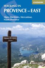
  • - Alpes Maritimes, Alpes de Haute-Provence, Mercantour
    av Janette Norton
    195,-

    Guidebook to 30 varied day walks in the east of Provence in the Alpes Maritimes, Alpes de Haute-Provence and Mercantour, with practical information for the walker. Walks span from the Esterel on the coast to the Mercantour, and include the Verdon Gorge and Geological Reserve of Haute Provence, from bases such as Vence, Grasse and Digne-les-Bains.

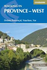
  • - Drome Provencal, Vaucluse, Var
    av Janette Norton
    195,-

    Guidebook to 30 varied day walks in the west of Provence in the Drome Provencale, the Vaucluse and the Var, with practical information for the walker. Walks span from the Baronnies in the north to the Ste-Baume ridge in the south and can be tackled from charming bases such as Nyons, Apt and Aix-en-Provence.

  • - 50 Walks in England's remotest Area of Outstanding Natural Beauty
    av Paddy Dillon
    179,-

    A guidebook to day walks in the North Pennines Area of Outstanding Natural Beauty (AONB), across Cumbria, County Durham and Northumberland. The book includes 50 walks exploring England's 'last wilderness', ranging from 5 miles (8km) to 14 miles (23km). Most are circular, though there are some linear routes, and there is something to suit all abilities over a variety of terrain. Route descriptions are illustrated with OS mapping and colour photographs, and the book includes details of local transport services, accommodation and tourist information centres. The walks cover a variety of terrain, from flat railway trackbeds to pathless moorland, and provide the opportunity to explore the striking geological features and fascinating industrial heritage of the area.

  • av Peter Edwards
    219,-

    This guidebook describes 21 mountain biking routes in central and southern Scotland. It includes the 7stanes trail centre in Dumfries and Galloway, as well as cross-country routes in the Campsie Fells, Pentland Hills and Lammermuirs, the Galloway Forest, Tweed Valley, Cheviots and Lowther Hills. The routes range from 17 to 66km and are graded from moderate to very hard. Taking between 2 and 7 hours to complete, they are intended for reasonably fit mountain bikers with at least some experience. Detailed route descriptions are accompanied by 1:50,000 OS mapping, and the selected routes set out from various points across the area, including Greenock, Glentrool, Peebles and Milngavie, with good access from both Glasgow and Edinburgh. The guidebook also gives an overview of what the region's MTB trail centres have to offer, including the famous 7stanes trail centre, along with advice on equipment, maintenance and safety.Southern and Central Scotland is renowned for its superlative MTB trail centres, but the region's rolling hill country is also traversed by an extensive network of tracks, paths, forest roads and other trails providing endless possibilities for 'free range' mountain biking.

  • av Sean Benz
    255,-

    This guidebook to mountain biking routes in North and North West Scotland describes 25 MTB routes north of the Great Glen, Covering a large geographical area, including Fort William, Rannoch Moor, Glen Spean, Ben Nevis, Sutherland, Torridon and Skye, the routes give a real flavour of the variety of different bike riding available. The routes range from 19.5km to 73.25km, graded moderate to very hard. Many are long and committing, so good preparation and fitness are essential, and in some cases a willingness to "e;hike and bike"e;. Each route has a clear and detailed route description along with 1:50,000 OS mapping and a height profile. All routes have key information, including distance on and off-road, ascent, grade, time and the nearest pub and cafe. There is also advice on equipment, planning and preparation, and maintenance, before you hit the trails. Scotland is rightly regarded as one of the world's top mountain bike destinations, with magnificent riding and stunning scenery. From the self-proclaimed Outdoor Capital of the UK, Fort William, to the majesty of the Outdoor Hebrides, this guide you will access some of the wildest and remote parts of Scotland, offering scintillating single track, challenging descents, incredible mountain vistas and many rewarding days in the saddle.

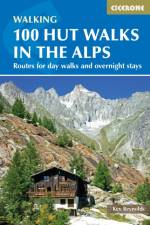
  • - Routes for day walks and overnight stays in France, Switzerland, Italy, Austria and Slovenia
    av Kev Reynolds
    215,-

    This popular guidebook by expert Kev Reynolds describes 100 walks focusing on the mountain huts of the Alps. With walks in France, Switzerland, Italy, Austria and Slovenia, there are routes to suit every taste - from gentle and undemanding to long and tough, as well as all varieties of difficulty in between. What they have in common is a visit to a hut, each with its own character. Some walks are perfect for lunch at a hut before a return to the valley base, others involve an overnight stay at a hut. In a few cases, a short hut-to-hut tour is suggested. The routes are grouped by country and by specific Alpine district. Most of the routes avoid any climbing of a technical nature, beyond the odd scramble aided by a fixed rope. Notes on hut etiquette, what to take and an English-French-German-Italian glossary are also included to help trekkers get the most out of their time in the Alps.

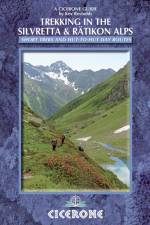
  • - Tour of the Silvretta, the Prattigauer Hohenweg and the Ratikon Hohenweg plus 12 day routes
    av Kev Reynolds
    245,-

    This guidebook describes 3 Alpine treks, between 5 and 8 days long, as well as 12 full or half day hut-to-hut routes. The three treks suitable for moderately experienced trekkers, but requiring no specialist equipment, are the Tour of the Silvretta, the Prattigauer Hohenweg and the Ratikon Hohenweg, two of which can be combined to provide a fortnight of high-altitude hiking among such peaks as Piz Buin, Piz Linard, Dreilanderspitz, Schesaplana, Sulzfluh and Drusenfluh and over some classic Alpine passes. The Silvretta and Ratikon ranges straddle the borders of Switzerland, Austria and Liechtenstein. Also included are descriptions of nearby climable peaks for those with excess energy and favourable conditions, and for those who prefer to plan their own tours a directory of all the mountain huts in the area, providing all the information you could possibly need. Written by Alpine expert Kev Reynolds, this book includes tips on gear, planning, language and further reading, to fully enjoy your time in the Alps.

  • - A Walker's and Trekker's Guide
    av Rudolf Abraham
    245,-

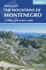
    This guidebook to Montenegro includes day-walks and multi-day treks throughout the Dinaric Alps, ranging from 1 hour to 5 days, with a selection of circular and linear routes, with variants and extensions. The 17 walks and trekking routes take in Montenegro's five national parks as well as other areas including Orjen, Komovi, Tara Canyon and the UNESCO-listed old town of Kotor. Walks are all graded, from easy outings to challenging treks involving exposure and scrambling. Many of the multi-day routes will require camping or staying in unstaffed mountain shelters. With a range of practical information on maps, language, travel to and around the country, and accommodation, this is a comprehensive and informative guide for walkers who wish to sample one of the finest walking destinations in Europe. These mountains are some of the wildest, most spectacular, and least visited in Europe. Nevertheless they are easily accessible, and many areas have well-marked trails. They present an opportunity to travel through outstandingly beautiful and remarkably unspoilt natural scenery, which sees few visitors.

  • - 50 classic hillwalking routes
    av Terry Marsh
    269,-

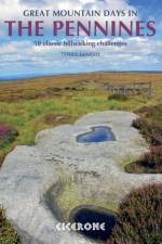
    An inspirational guidebook to 50 great walks throughout the Pennines. A wide range of routes in this larger format book have been selected to help walkers explore all aspects of this beautiful upland area. The walks are all graded, from moderate to strenuous, and are between 6 and 13 miles long, with plenty of options for both first-time and more experienced walkers. Ranging between the North Pennines, Howgills, Yorkshire Dales, South Pennines and Dark Peak, this guide offers the best of the mass of fell and moor that makes up the backbone of England. Routes include Cross Fell, Wild Boar Fell, Ingleborough, Whernside, Pen-y-Ghent, Pendle Hill, Kinder Downfall and a traverse of Ilkley Moor and many are suitable for fell running. The circular walks are all graded, making this guidebook equally suitable for first-time and more experienced walkers looking to explore new corners of the Pennines. All routes are illustrated with 1:40,000 OS mapping and plenty of colour photography.

  • av Kev Reynolds
    289,-

    An inspirational larger format book describing 20 memorable treks in the Himalaya. They include such well-known classics as the treks to Everest, K2 and Kangchenjunga base camps, and the Annapurna and Manaslu Circuits. The ultra-long Lunana Snowman Trek and a kora around sacred Mount Kailash in Tibet are also included. There are epic glacier treks like that to Pakistan's Snow Lake; following in the footsteps of Shipton and Tilman towards Nanda Devi, and the approach to Gangkar Punsum - the world's highest unclimbed peak located in remote Bhutan. This inspirational guide was edited by trekking specialist Kev Reynolds, and written by a team of eight experienced authors, writers and guides. A compilation of the best walking in the Himalaya, it looks at each trek in turn, and discovers what makes the trek special, and entices with vivid accounts and breathtaking photography.

  • - Cicerone Press
    av Justi Carey & Roy Clark
    235,-

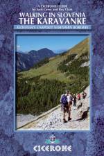
    This guidebook describes 23 walking routes across the 120km-long Karavanke mountain range, which forms a natural border between Austria and Slovenia. The one and two-day routes cater for all abilities, from low-level walks to high summits. The approaches are mainly from the forested valleys of the Slovenian side, with bases including Kranjska Gora, Mojstrana and Trzic. Arranged peak from west to east along the range, the routes feature major highlights including Stol (at 2236m the highest in the range and one that forms a stunning backdrop to the beautiful Lake Bled), the majestic Kosuta ridge and Golica - a mountain that displays a fine carpet of white daffodils in May. The guide gives all the practical details you need on transport, accessing the routes, accommodation and available facilities, as well as insight into the historical sites passed on the way. The Karavanke offers a wealth of superb walking opportunities for walkers of all abilities, and this is an invaluable companion to discovering the range for yourself.

  • - Dorset and East Devon - The walks, the rocks, the fossils
    av Ronald Turnbull
    215,-

    This guidebook describes 30 walking routes along the Devon-Dorset coast. The majority of the routes hug the shoreline between Torbay and Swanage, while others venture inland on the Dorset Downs. The walks range in length from 3 to 20 miles (5 to 33km) and are suitable for most walkers, with shorter routes alongside plenty of more challenging, full-day hikes. As well as detailed descriptions for every walk, accompanied by OS maps, there are details on available parking, points of interest along the way and advice on the terrain covered. The guide has been divided into areas: Devon's Red Beds, the Lias, Chesil Beach, Chalk walks (Lulworth and inland) and the Isle of Purbeck. The geological descriptions are accompanied by strata diagrams, geological timelines, explanations of the creation of the various sedimentary rocks along the coast, and discussion of how and why the various formations formed millennia ago. The incredible - yet readable - detail brings these walks and the landscape alive. The Jurassic Coast of Devon and Dorset, stretching between Exeter and Bournemouth, is a geological wonderland. Natural wonders like Chesil Beach, Durdle Door and fossils so numerous you'll be tripping over them, combine with southern England's rolling Downs, tiny villages, beaches and sunny summers to provide a stunning and awe-inspiring landscape to explore.

  • - Snow, ice and mixed climbs in the English Lake District
    av Brian Davison
    279,-

    Essential guidebook to the best winter climbing routes in the Lake District. All the known routes in every part of the Lakes are described. From classic high-mountain gullies and buttresses on crags such as Scafell, Pillar and Great Gable to frozen watercourses and icefalls including Great Gully on the Wasdale screes.

  • - Summer routes for a multi-activity holiday in the shadow of Mont Blanc
    av Hilary Sharp
    255,-

    This guidebook shows the vast range of activities available in the mountains surrounding Chamonix. With routes for several different pursuits including walking, trail running, mountain biking, road cycling, via ferratas, rock climbing, mountaineering and bouldering, it is a comprehensive collection of everything this popular region has to offer. All the routes and activities range in difficulty, from easy strolls for all abilities to moderate rock climbs and glacier hikes, which require either technical skills or a professional guide. Families, groups of friends and mountaineers looking for a 'rest day' or a change to what they're used to will all find something to whet their appetites here. Chamonix has long been a dream destination for mountain adventures and its environment is ideal for such a varied list of activities. This guide allows you to enjoy its spectacular views and renowned summits in many different ways or by mixing and matching your favourites.
  • - Italy's largest alpine national park
    av Gillian Price
    245,-

    The 38 summer day walking routes in this guidebook explore the renowned Stelvio National Park in the Italian Rhaetian Alps. Bordering the Dolomites to the east, and Switzerland to the west, the Stelvio is one of the largest protected areas in all of the Alps. The walks explore each of the Stelvio's valleys, are graded for difficulty and range from 4 to 18km. There is plenty for active holidaymakers; from easy strolls to strenuous climbs to panoramic summits for experienced walkers. The Stelvio's unspoilt landscape ranges from valley farmland to forested hillsides and alpine meadows, and up to a wilderness of rugged glaciated summits and ridges, the highest of which is Ortler, at 3905m. The guidebook also includes plenty of background information on local wildlife and cuisine, as well as planning details such as what to take and dos and don'ts. The guide also contains accommodation suggestions, including campsites, B&Bs, hotels and mountain huts in the National Parks picturesque towns and villages such as Bormio, Sulden and Martell Dorf. Close to Milan, Verona and Innsbruck, with good public transport throughout, the Stelvio National park offers extensive, spectacular Alpine walking, with this as the first English-language guide to the area.

  • - Rum, Eigg, Muck, Canna, Coll and Tiree
    av Peter Edwards
    215,-

    This guidebook describes 16 routes across Rum, Eigg, Muck, Canna, Coll and Tiree, suitable for a wide range of abilities, and exploring coast, mountains and wilderness. The 15 day walks include a challenging round of the Rum Cuillin, and the one 3-day 55km backpacking route heads around the Rum coastline, sometimes over pathless and tough terrain. Each route provides OS 1:50,000 mapping, information on distance, ascent, time and terrain, as well as details of any variants or shortcuts. The Small Isles are often called the hidden gems of the Western Isles, providing a walking paradise for those seeking wilderness and solitude, alongside the better-known Rum. Highlights include, on Rum, the towering volcanic peaks of the Rum Cuillin, Kinloch Castle, Kilmory bay; An Sgurr and Cleadale on Eigg; Canna's towering cliffs and rock stacks; the verdant landscape and sparkling shores of Muck; and the white sand bays and flower-carpeted machair of Coll and Tiree. Each island is different and has its own introduction here, with detailed information on geology, history and wildlife, as well as local amenities.

  • - 66 routes between Geneva and Briancon
    av Richard Miller
    299,-

    The 66 via ferrata routes in this guidebook are grouped by area - Geneva and the Northern Alps, Chambery, the Tarentaise and Maurienne valleys, Grenoble and Briancon - and run the full gamut of challenge, from very easy, protected routes suitable for children, through to extremely exposed and technical routes for experienced ferratists only. Routes are illustrated by topo diagrams on colour photographs, and simple sketch maps. Those used to the older Italian routes will find these French routes quite different, closer to scrambling or rock climbing and often seeking out the most vertigo-inducing terrain. But most routes should be within the reach of any strong hillwalker and protection is high and well maintained. Recent years have witnessed a surge in the number of via ferrata routes set up in the iconic mountains of the French Alps. With routes set on or near many classics including the massifs of Mont Blanc, the Vanoise and the Queyras, this guide shows the best of what is now available.

Gör som tusentals andra bokälskare

Prenumerera på vårt nyhetsbrev för att få fantastiska erbjudanden och inspiration för din nästa läsning.