Marknadens största urval
Snabb leverans

Böcker utgivna av Arcadia Publishing Library Editions

Filter
Filter
Sortera efterSortera Populära
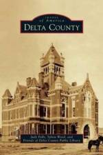
  • av Judy Falls, Sylvia Wood & Friends of Delta County Public Library
    385,-

    During the frenetic days of Reconstruction, Delta County claimed land between two branches of the Sulphur River, from Lamar and Hopkins Counties, and named itself after its shape and the third letter of the Greek alphabet. From its early days, Delta County became home to prosperous farmers who relocated from the South and who brought with them their knowledge of growing cotton as well as their traditions and cultures. At its heyday in the 1920s, the county boasted the densest rural population in the state. These pioneers believed strongly in education, and more than 40 schools dotted the county at one time, with many graduates of these rural schools becoming doctors, engineers, teachers, politicians, ministers, authors, musicians, lawyers, coaches, scientists, and athletes--as well as one All-American. For those who remained, those who returned, and those who chose this quiet corner of Northeast Texas, Delta County is home, with all the sweet and poignant implications of that word.

  • av Mason County Historical Commission
    385,-

  • av Dan W Messersmith
    359,-

    Kingman, county seat of Mohave County in northwestern Arizona, owes its beginning and subsequent prosperity to the building of the Atlantic and Pacific Railroad in 1882. The city was named for the project's chief engineer, Lewis Kingman. The initial railroad siding quickly became a supply center for mining and ranching operations that dotted the beautiful surrounding valleys and mountain ranges. Through the years, Kingman has been at the crossroads of rail, highway, and air transportation routes. A B-17 bomber gunnery training base brought changes by exposing the area's potential to thousands of soldiers during World War II, many of whom would later return. Actor Andy Devine grew up here, Clark Gable and Carole Lombard were married here, and Charles Lindbergh would establish a route for Transcontinental Air Transport through here. Today Kingman is the "Heart of Historic U.S. Route 66" and is located in the middle of the longest remaining stretch of the "Mother Road," making it a must-see destination for thousands of tourists each year.

  • av Tammy Burrow Schrecengost
    359,-

    In West Texas, the land that would one day become Big Spring was originally home to Comanche Indians. In 1880, the Texas Rangers were sent ahead of the railroad to establish peace among the ranchers and to protect the western frontier from the Comanche who lived there. New Texans began to follow the railroad from Colorado City to Big Spring, which was named the county seat of Howard County in 1882. The small Texas town once known for its saloons, dance halls, shoot-outs, and gambling grew into an oil- and agriculture-rich community. This pictorial collection illustrates the continual progress that Big Spring has made, from the first wooden buildings thrown together on First and Main Streets to the discovery of oil. Big Spring also experienced economic booms with the building of an oil refinery, an air force base, and the rise of the cattle industry. Today this once-small West Texas town is dotted with wind farms, an oil refinery, and three hospitals.

  • av Lasker M Meyer
    359,-

    The story of Foley's began in Ireland in the late 1800s when William L. Foley set sail for America. Ambition led him to Houston, where he opened a store and hired his two nephews, Pat C. and James. The nephews quickly felt an entrepreneurial urge to run their own store, so their uncle gave them $2,000 to get started. On February 12, 1900, the Foley Brothers Dry Goods Company at 507 Main Street opened for business. Approximately 44,000 residents visited the store that day, and sales of $128.29 were tabulated. Soon after Spindletop was discovered, Robert I. Cohen of Galveston bought the Foley Brothers company for his son George S. Cohen to operate. Cohen, along with the aid of six of the eight Meyer brothers from Galveston, built it into the largest store in Texas. In 1945, Fred Lazarus, from the department store clan in Ohio, came to Houston to visit his son at Ellington Field. He saw Houston's potential, and in 1946, Foley Brothers became Foley's, owned by Federated Department Stores.

  • - The Mounted Police
    av Chuck Hornung
    359,-

    The New Mexico Mounted Police were forged from a frontier civil crisis and hammered to life upon the anvil of necessity. The Sunshine Territory of New Mexico had become the last outlaw haven in the Southwest. In the tradition of their red-coated namesake, the Northwest Mounted Police of Canada, this small band of range riders used their fists, guns, and brains to restore law and order during the closing years of New Mexico's territorial era. They carried their mission forward into the early days of statehood.

  • av William Ascarza
    385,-

    The Tucson Mountains are located several miles west of downtown Tucson. For thousands of years, this mountain range has been inhabited, explored, and traveled by Native Americans who settled near the Santa Cruz River. Homesteaders, prospectors, and ranchers arrived in the late 19th century, drawn by the area's close proximity to Tucson and the Southern Pacific Railroad, as well as the promise of land and mineral wealth. During the past 100 years, conservation efforts to preserve and enhance the community's understanding of this geologic treasure have led to the establishment of museums and parks, including Tucson Mountain Park, the Arizona-Sonora Desert Museum, and Saguaro National Park West. Old Tucson Studios has used the surrounding Tucson Mountains as a movie backdrop for more than 70 years. The White Stallion Ranch and the J. W. Marriot at Starr Pass make the Tucson Mountains a popular destination for visitors who want to experience the rugged beauty and character of the American Southwest.

  • av Cindy Carpenter & Sherry Fletcher
    385,-

    "Hot Springs, New Mexico, Ain't That Any More" was one of the headlines on April 4, 1950, in the Gallup Independent. As a publicity stunt, Ralph Edwards had invited a town to change its name to "Truth or Consequences," the name of his popular radio quiz show, and Hot Springs agreed to do so. Since the late 1800s, the area has attracted health seekers to bathe in and drink from the area's hot mineral springs. The region is home to Elephant Butte Dam and lake, completed in 1916, which remains one of the largest irrigation dams in the United States. Carrie Tingley Crippled Children's Hospital, built in 1937 by New Mexico governor Clyde Tingley, utilized the natural hot mineral waters to treat children with polio. From the placement of the Hot Springs Bathhouse and Commercial District on the State and National Register of Historic Places to the centennial celebration of Elephant Butte Dam, Truth or Consequences continues to grow and develop while still honoring its heritage.

  • av Christine Wyly
    359,-

    "Author Christine Wyly is an Amarillo realtor whose interests in architectural design and history drew her to this project. Wyly collected vintage images from the pioneer families and current residents of the Woflin Historical District, as well as from the archives of the Amarillo Public Library to tell the story of Amarillo's Historic Wolfin District"--P. [4] of cover.

  • av Laurie J Wilson & Peggy Holland Rankin
    385,-

    The Houston and Texas Central Railroad made its way through eastern Ellis County in 1871 and played an integral role in the founding of Ennis, Texas. Eventually, that community would be designated as a division point along the line. The H&TC's arrival also brought growth and prosperity to other communities on the line, including Alma, Garrett, Palmer, and Ferris. It made its mark on the area. The Waxahachie Tap was the vision of many of that city's earliest settlers. Within a decade of its completion in September 1879, Waxahachie's cotton production multiplied and the town would soon earn the moniker "Where Cotton Is King." Midlothian and its surrounding communities would never be the same once connected by the Chicago, Texas, and Mexican Central Railroad in 1881. The rail had arrived and Ellis County was transformed.

  • av Red River County Historical Society
    385,-

  • av John L Jacquemart & Donna J Reiner
    359,-

    For more than 80 years, the remarkable, wedding cake-like structure located on the eastern fringe of Phoenix has intrigued residents and visitors alike. Perched on a granite promontory, Tovrea Castle at Carraro Heights reflects the dreams of several people. Alessio Carraro started construction in 1929, but the Depression spoiled his dream of a magnificent resort. E. A. Tovrea purchased the property in 1931 but died soon thereafter. Tovrea's widow, Della, after marrying William Plato Stuart in 1936, moved back and forth between the castle and Prescott, depending on the weather. When Stuart died in 1960, Della lived in the castle until her death in 1969. For many years after her death, the castle stood lonely and neglected, and it held its mystique because few people were ever invited inside. In 1993, the castle and surrounding acreage were acquired by the City of Phoenix for a new purpose: transformation into a city park.

  • av Steve Ayers & Camp Verde Historical Society
    385,-

    In February 1864, a party of 17 men and two women left the security of the territorial capital at Prescott, Arizona, and headed east into the Verde Valley, homeland of the Yavapai and Apache. Drawn by the promise of ample water, rich bottomland, and lush grassland, the party established a farming and ranching community near the confluence of West Clear Creek and the Verde River. In spite of conflict with the Yavapai and Apache, the settlement survived, due in part to the establishment of a military presence late that summer. Over the next 35 years, the settlement at Lower Verde thrived around the army fort, and became known as Camp Verde. In 1891, Fort Verde was abandoned, and the surrounding land opened to homesteading in 1895. The post sold at auction in 1899. Built among the ruins of the ancient Sinagua culture and situated along the banks of the Verde River, Camp Verde remains an agricultural paradise and a haven for those wanting to escape city life.

  • av Susan McKeague Karnes
    385,-

    In the mid-19th century, a few hardy settlers of European descent carved out farms in the Clear Fork Valley of present-day Parker County, attracted by the area's springs, tributaries, and a burgeoning market in nearby Fort Worth. For centuries, Comanche and Kiowa had inhabited the land, and a period of dramatic conflict ensued, exacerbated by the Civil War absence of able-bodied husbands and sons. By 1880, ranches and settlements flourished, aided by the Fort Worth-Yuma cattle trail and a Texas and Pacific Railway line connecting Fort Worth to the county seat of Weatherford. As the first mail stop in the newly formed county, Aledo was briefly dubbed Parker Station before having its name changed in 1882--a bow to a railroad engineer's Illinois hometown. Today segments of Bankhead Highway, the nation's first paved transcontinental highway, wind around Aledo, the Annettas, Willow Park, and Hudson Oaks, thriving communities that offer a pastoral lifestyle minutes from the urban amenities of the Fort Worth-Dallas Metroplex. Mere fragments remain of Newburg, Prairie Hill, Willow Springs, and other old settlements, visible only to old-timers and lost to living memory.

  • av Carol, PhD Msn RN Taylor & Hunt County Historical Commission
    385,-

    Located on the rolling Blackland Prairies of Northeast Texas, Greenville was founded in January 1847 as the county seat of Hunt County. Through the years, it became not only the seat of local and county government, but the economic, social, and cultural center of much of the area. With the arrival of the railroads in 1880, Greenville became a market center for cotton, livestock, and other agricultural products, and a vast assortment of goods were available to discerning shoppers. Paved roads, a professional theater, baseball, football, and the North Texas Fair brought visitors to Greenville from the surrounding areas. Merchants, bankers, and entrepreneurs worked diligently to create a community of modern conveniences, beautiful homes, churches, and schools. One of the first municipally owned power plants opened in Greenville in the late 19th century. Though they do keep up with the times, Greenville residents continue to honor their town's remarkable history.

  • av Garza County Historical Museum & Linda Puckett
    385,-

    Garza County was created in 1876 and named by Texas legislators in honor of the de la Garza family of San Antonio. The county lay claim to vast ranch lands with the picturesque cap rock escarpment weaving its way from north to south. Though the 1880 census listed the population as a sparse 36 people--mostly landowners and cowhands--cattlemen like John B. Slaughter and W. E. Connell owned massive spreads in excess of 100,000 acres with more than 5,000 head of cattle and 100 horses. By 1900, the population had grown to 180, with only 545 acres in cultivation. Things changed with the arrival of cereal magnate C. W. Post, who came to Garza County to begin building his model town and experimental farming campaign. On June 15, 1907, an election to organize the county was held and Post City became the official county seat, touting the slogan "Gateway to the Plains."

  • av John Lemay
    385,-

    Lincoln County is often associated with such legendary figures as outlaw Billy the Kid, Smokey the Bear, and renowned painter Peter Hurd. Named after Pres. Abraham Lincoln in 1869, the new county saw itself through many struggles, including the Lincoln County War, during which cattle barons and landowners bitterly fought over government beef contracts and farmland. At that time, Lincoln was the largest county in the United States and is now home to modern mountain towns such as Carrizozo, Capitan, Ruidoso, and the locally famous ghost town White Oaks, which had been a gold rush boomtown. Lincoln County also contains the beautiful Hondo Valley settlements and ranching communities such as Tinnie, Picacho, San Patricio, Hondo, and Glencoe. From the rolling hills of the Hondo Valley, to the bloody streets of Lincoln, all the way to the forested mountains of Capitan, this retrospective explores the area's rich history.

  • av Paul N Spellman
    359,-

    On a bend in the Colorado River where it meanders through the Bay Prairie lies the town of Wharton. Caney and Peach Creeks spill into the river nearby and mark the boundaries of this small community. Stephen F. Austin first brought settlers here in the early 1820s, and the town of Wharton was organized in 1846. Named in memory of two brothers who fought in the Texas Revolution, the town sits astride trade routes that connect larger cities like Houston and San Antonio. Steamboats made their way up the Colorado River, and the railroad bustled through in the 1880s. The town began to grow quickly by 1900, and now, a century later, Wharton honors a diverse cultural heritage passed down for six generations. Today Wharton has more than 9,000 residents who make up a diverse and thriving community, and who still appreciate their special place along the mighty Colorado River.

  • av Joyce Williamson, Lucile Estell & Pat Smith-Gassperson
    385,-

    Nestled among towering pine trees in East Texas is the city of Marshall. Marshall is closely identified with Caddo Lake, a massive body of water located northeast of the town. According to the Caddo Indians who first inhabited this land, the mysterious lake was formed overnight from an earthquake. Spanish and French explorers sought to claim the land as their own in the 16th century, and American settlers arrived here in about 1830. The city of Marshall was founded in 1842, eventually becoming the county seat of Harrison County. With the arrival of the Texas and Pacific Railroad after the Civil War, Marshall became known as the "Gateway to Texas," and the town prospered. Today education plays an important role in the local economy, and Marshall is the home of Wiley College, East Texas Baptist University, and Texas State Technical Institute. Life in Marshall continues to revolve around the town square, with the majestic, restored courthouse at its center.

  • av Janice Craze Cline
    385,-

  • av Rosenberg Railroad Museum & Jim Vollmar
    385,-

    Fort Bend County was formed in the early 1820s by members of Stephen F. Austin's "Old 300." Traders utilized barges and steamboats running along the Brazos River to transport cotton and other products from the lower Brazos Valley to the port at Galveston. In 1853, railroads began to play a larger role in the county's transportation system. Transportation facilities were greatly improved when the first railroad in Texas, the Buffalo, Brazos, and Colorado Railroad Company, completed its first 20-mile segment to Stafford's Point in Fort Bend County from Harrisburg (Houston). As many as eight separate railroads were chartered and operated in Fort Bend County by 1900. Today some of the names have changed but most of the original rail lines remain in operation. The Union Pacific, Burlington Northern Santa Fe, and Kansas City Southern rail companies have picked up where their predecessors left off and are keeping Fort Bend County one of the busiest and fastest-growing counties in the United States.

  • av Sue Bybee
    385,-

    Nestled at the foot of the Wasatch Mountains is a small community with a grand history. The area's first inhabitants were Native Americans until eight Mormon families arrived in 1850. With the coming of the railroad in 1869, Uintah quickly became a wild and woolly boomtown with more than 100 businesses and a population of about 5,000. But when the Utah Central Railroad moved to Ogden, many people moved out of Uintah. Still, this spirited town has survived, and every year, U-Day celebrates the history of the town with various events and the lighting of the historic "U." Originally built by Uintah residents and located on the northern side of Weber Canyon, the "U" is a meaningful symbol of Uintah's past and present. To this day, Uintah retains its small-town character, and residents honor the history of their town.

  • av James Collett
    385,-

    Midland was a young farming and ranching community on the southern edge of the Llano Estacado when the real-photo postcard era began near the opening of the 20th century. Businesses, residents, and promoters embraced this new technology to produce images capturing Midland's unusual rural-and-cosmopolitan mix. As postcards changed to linen and chrome, Midland also underwent dramatic changes. The city on the plains worked hard to become an indispensable part of the vast 1920s Permian Basin oil industry. In post-World War II years, Midland grew into an urban center of West Texas, positioned strategically at the midpoint of Interstate 20's path from Fort Worth to El Paso.

  • av David W Keller
    385,-

    "Alpine was born a railroad town, but long before the whistle of the steam locomotive broke the silence of Alpine Valley, the nearby spring was a favored campground for prehistoric nomads and later for Spanish explorers and freighters along the Chihuahua Trail. When the Southern Pacific unfurled its line down from Paisano Pass in 1882, landowner Thomas Murphy saw opportunity and platted the town. In 1887, Alpine was chosen as the county seat, and with the opening of Sul Ross Normal College in 1920, the town became the academic hub of the region. Following a decade of prosperity, the Great Depression and recurrent droughts triggered a slow decline. But since the early 1990s, Alpine has enjoyed a surge in regional art and culture, allowing it to reclaim its former glory as a proud little cosmopolitan cowtown perched at the top of the Texas Big Bend"--Provided by publisher.

  • av Juliet George
    359,-

    On the prairie west of Fort Worth, British-born Humphrey Barker Chamberlin commissioned a model mansion, grand hotel, trolley line, lake, and waterworks in the early 1890s. He launched Chamberlin Arlington Heights as an opulent suburb reminiscent of his Capitol Hill enclave in Denver, then lost his overextended empire in the silver panic of 1893. Although several more well-to-do families established homes near those of the original "Heights pioneers," development progressed slowly. With the coming of World War I, local leaders persuaded the U.S. Army to build Camp Bowie across much of the sparsely settled area, providing infrastructure. A bungalow boom followed, with housing additions for the middle class and annexation by Fort Worth. As the 20th century drew to a close, preservationists sought protection for the legacy of built treasures within the neighborhood.

  • av Dallas Municipal Archives & John H Slate
    359,-

    Dallas, called "Big D," is the eighth largest city in the United States and rests on 343 square miles of rolling prairie. To meet the growing recreational and cultural needs of its citizens, the Dallas Park and Recreation Department maintains more than 23,018 park acres--one of the largest municipal park systems in the country. Dallas has over 400 individual parks, including community centers, swimming pools, athletic fields, and a metropolitan zoo. From such well-known places as Fair Park, home of the State Fair of Texas and the Texas Centennial Exposition of 1936, to Dealey Plaza, and to lesser-known neighborhood parks, Dallas parks have a rich history stretching from the days when Dallas was a western boom town to a 21st century metropolis. Historic Dallas Parks explores the origins and early development of this nationally recognized system with interesting background stories and facts and illustrated with photographs and historical documents from the collections of the Dallas Municipal Archives.

  • av Patrick Whitehurst
    359,-

    With the glamorous Grand Canyon as its backyard, Tusayan has a fascinating history. Dedicated just one year after the Grand Canyon National Park, the village of Tusayan had its humble beginnings in 1920 as a small sheep ranch operated by the Hull brothers. Tusayan quickly became a hub for the millions of travelers who made their way to the Grand Canyon each year. The two areas share a mutual school, a health care center, and other amenities. Other pioneers, such as R. P. Thurston, helped ensure the area's longevity with the addition of Highway 64 through the center of the village and the arrival of the Grand Canyon Airport, making Tusayan one of the most visited little towns in northern Arizona.

  • - Bartlett and Horseshoe Dams
    av Gerard Giordano
    359,-

    Archaeologists discovered that the Hohokam were an advanced native tribe who built elaborate irrigation systems along the Verde River, and then disappeared. Early Arizona settlers recognized the tenacity and intelligence of the Hohokam and began to reconstruct their canal system. In 1903, the Salt River Project commenced, and the first lake on the lower Verde River was formed with the completion of the Bartlett Dam in 1939. Seven years later and 12 miles upstream from Bartlett, the Horseshoe Reservoir was created in order to expand copper mining during World War II. The astonishing result of these reservoirs is today's sprawling desert megalopolis of Phoenix, Arizona. Nicknamed "The River of Time," the Verde River is a timeline of Arizona history, and it is essential to human life and livelihood in the area.

  • av E. John Jr. Gesick & Seguin-Guadalupe County Heritage Museum
    385,-

  • av Haskell County Historical and Genealogic
    385,-

Gör som tusentals andra bokälskare

Prenumerera på vårt nyhetsbrev för att få fantastiska erbjudanden och inspiration för din nästa läsning.