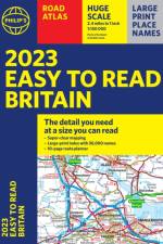
Marknadens största urval
Snabb leverans

Böcker av Philip's Maps

Filter
Filter
Sortera efterSortera Populära
  • av Philip's Maps
    245

    The only county Street Atlas with all the named streets of Derbyshire and the Peak District and perfect back-up for emergency services, delivery drivers, visitors and locals.

  • av Philip's Maps
    245

    Philip's created this new series for walkers, cyclists and local explorers at a scale that provides greener options to uncover all the nature and hidden gems in your local area. From Beeston to Tickwell, we cover Nottinghamshire in enticing detail.

  • av Philip's Maps
    245

    The only county Street Atlas with all the named streets of Nottinghamshire and perfect back-up for emergency services, delivery drivers, visitors and locals.

  • av Philip's Maps
    245

    Philip's created this new series for walkers, cyclists and local explorers at a scale that provides greener options to uncover all the nature and hidden gems in your local area. From Chippenham to Wilton, we cover Wiltshire and Swindon in enticing detail.

  • av Philip's Maps
    245

    The only county Street Atlas with all the named streets of Wiltshire and Swindon and perfect back-up for emergency services, delivery drivers, visitors and locals.

  • av Philip's Maps
    245

    Philip's created this new series for walkers, cyclists and local explorers at a scale that provides greener options to uncover all the nature and hidden gems in your local area. From Bury St Edmunds to Woodbridge, we cover Suffolk in enticing detail.

  • av Philip's Maps
    235

    The only county Street Atlas with all the named streets of Suffolk and perfect back-up for emergency services, delivery drivers, visitors and locals.

  • av Philip's Maps
    235

    Philip's created this new series for walkers, cyclists and local explorers at a scale that provides greener options to uncover all the nature and hidden gems in your local area. From Aylesbury to Wolverton, we cover Buckinghamshire in enticing detail.

  • av Philip's Maps
    245

    The only county Street Atlas with all the named streets of Buckinghamshire and Milton Keynes and perfect back-up for emergency services, delivery drivers, visitors and locals.

  • av Philip's Maps
    245

    Philip's created this new series for walkers, cyclists and local explorers at a scale that provides greener options to uncover all the nature and hidden gems in your local area. From Abingdon-on-Thames to Wootton, we cover Oxfordshire in enticing detail.

  • av Philip's Maps
    245

    The only county Street Atlas with all the 11,000 named streets of Oxfordshire and perfect back-up for emergency services, delivery drivers, visitors and locals.

  • av Philip's Maps
    169

    Created specially for CXC Geography students in secondary schools and colleges, this market-leading atlas provides extensive, up-to-date coverage for each country in the Caribbean region, combined with a comprehensive set of world and regional maps.

  • av Philip's Maps
    199

    The detail you need - at a size you can read. Our newest edition of the bestselling 2024 Easy to Read Britain Road Atlas from Philip's has super-clear, large-scale, large-print maps that everyone can read easily. Practical and chunky A4-sized paperback with handy flaps to help plan any journey.

  • av Philip's Maps
    169

    Clear and detailed mapping covers the whole of Europe including western Turkey. With scenic routes, beaches, theme parks, ski resorts and World Heritage Sites, alongside European driving regulations, key travel information and an illustrated listing of the Top 300 not-to-be-missed sights.

  • av Philip's Maps
    379

    Philip's Navigator Trucker's Road Atlas is the UK's biggest and most detailed road atlas. With large-scale mapping that makes driving easy in both towns and the countryside, it has lie-flat spiral binding for easy use. Additional information on bridge heights, width restrictions, weight limits - vital information for drivers of large vehicles.

  • av Philip's Maps
    355,-

    Philip's Navigator are Britain's bestselling road atlases - exceptional for their scale and clarity. 'A map that beats all others' The Daily Telegraph 'Scale, accuracy and clarity are without parallel' Driving Magazine 'No.1 in the UK for clear maps' Independent research survey - Scale: 1.5 miles to 1 inch = 1:100,000 (Northern Scotland: 3 miles to 1 inch = 1:200,000) - Super-detailed 6-page route-planning section. - Every street in Britain is marked on the maps. - Over 3000 roads clearly named. - Featuring major National Trails such as: Hadrian Wall's Path, Offa's Dyke Path, Pennine Way, South Downs Way, Thames Path, The Ridgeway, West Highland Way and Southern Upland Way. - 100 indexed town-centre maps plus approaches maps to 12 major urban areas. - Exceptional road detail, from motorways to country lanes, with every junction, roundabout and slip-road shown. - Thousands of individually named farms, houses and hamlets. - The No.1 Choice of Road Atlas for the serious motorist. Available in a robust flexiback binding, Philip's Navigator Britain is widely used by professional drivers and the emergency services, including national police training, and is recommended in the motoring press and national newspapers. No other road atlas of Britain offers this level of detail and clarity.

  • av Philip's Maps
    115,-

    This pocket-sized street atlas of the Isle of Wight gives detailed coverage of the whole of the island and mainland towns nearby.

  • av Philip's Maps
    245

    Philip's created this new series for walkers, cyclists and local explorers at a scale that provides greener options to uncover all the nature and hidden gems in your local area. From Bath to Yatton, we cover all of Somerset in glorious detail.

  • Spara 11%
    av Philip's Maps
    179,99

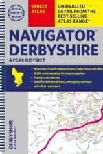
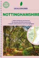
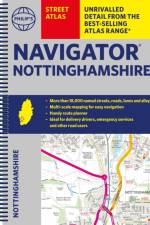
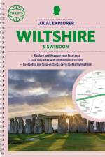
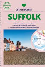
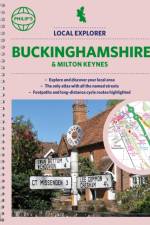
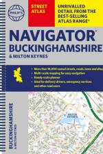
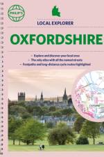
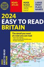
    Who hasn't explored and enjoyed their surrounding area recently and come to appreciate what is on our respective doorsteps? Philip's have created this new series for walkers, cyclists and local explorers at a scale that provides greener options to uncover all the nature and hidden gems in the local area. The detailed scale allows explorers, walkers and cyclists to avoid main roads and select pathways, bridleways and lanes for optimum enjoyment. Whether it's meandering through the local parks or historic houses, exploring neighbourhood nature spots or the local town, we have the clear mapping and information you need. If you do have to travel to reach areas you'd like to explore, all A and B roads are clearly shown on our Route Planner and we include all the large-scale town and city plans. Exceptional detail allows the user to pinpoint exactly where they need to go and the best route to follow. * The only atlas with every road, street and lane in the area named, along with the best pedestrian routes, long-distance cycle routes. * Highlighting lanes, alleyways, footpaths and bridleways, camping and caravan sites, golf courses, parks, gardens and many, many other places of interest * Contains all the usual one-way streets, barriers, car parks, railway and bus stations, hospitals, colleges and schools, police and fire stations, places of worship, post offices, shopping and leisure centres

  • av Philip's Maps
    245

    Philip's created this new series for walkers, cyclists and local explorers at a scale that provides greener options to uncover all the nature and hidden gems in your local area. From Chester to Winsford, we cover all of Cheshire in intriguing detail.

  • av Philip's Maps
    245

    The only detailed colour atlas that gives comprehensive coverage of the entire region - no other atlas names every street in Cheshire. The perfect back-up for emergency services, delivery drivers and locals.

  • av Philip's Maps
    245

    The only detailed colour atlas that gives comprehensive coverage of the entire region - no other atlas names every street in Somerset. The perfect back-up for emergency services, delivery drivers and locals.

  • Spara 11%
    av Philip's Maps
    179,99

    The only detailed colour atlas that gives comprehensive coverage of the entire region - no other atlas names every street in Cornwall and Plymouth. The perfect back-up for emergency services, delivery drivers and locals.

Gör som tusentals andra bokälskare

Prenumerera på vårt nyhetsbrev för att få fantastiska erbjudanden och inspiration för din nästa läsning.