Marknadens största urval
Snabb leverans

Böcker av Paddy Dillon

Filter
Filter
Sortera efterSortera Populära
  • av Paddy Dillon
    235

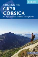
    This guidebook describes the classic GR20 trek, a north-to-south traverse of the rugged mountains of Corsica, renowned as Europe's toughest GR long-distance route. Described in 16 stages, some with high and low-level alternatives, the route is roughly 190km in length and takes approximately two weeks to complete. The GR20 climbs high into the mountains. It is a demanding trek suitable only for experienced walkers, and there are several steep 'hands-on-rock' sections calling for a sure foot and a good head for heights. It is possible to stay under a roof every night but many trekkers opt to camp. Step-by-step descriptions of each stage are accompanied by 1:50,000 mapping, together with information on ascent/descent, terrain and the availability of food, water and accommodation/shelter. There is also invaluable practical information such as path conditions, what to take, and getting to/from and around Corsica. Overviews of the history and geology of the island and local plants and wildlife are offered to enhance the trekking experience. Finally, a separate map booklet, included with the guide, provides all the 1:25,000 IGN mapping needed to complete the GR20. Starting in Corsica's northwest, in picturesque Calinzana, the route winds southeast through the heart of the island, finishing on the eastern side, just north of Porto Vecchio in the township of Conca. It showcases Corsica's rich diversity of landscapes and ethereal beauty. Bare rock and sheer cliffs contrast with black sand beaches, alpine pastures, maquis and pockets of forest. There are also opportunities to detour from the route to visit traditional mountain towns and villages for a taste of Corsica's vibrant history and culture and to take in neighbouring summits, including the island's highest peak, Monte Cinto. For those up to the challenge of hiking part or all of the route, the GR20 promises adventure, memorable experiences and rich rewards.

  • av Paddy Dillon
    245 - 255,-

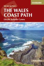
    The Wales Coast Path offers an unparalleled opportunity to walk a nation's coastline in its entirety. Stretching 1400km (870 miles) from Chester to Chepstow, including Anglesey, the waymarked trail takes 2-3 months to complete but can easily be broken into shorter sections. The walking is generally not difficult, although there are occasional rugged sections, steep ascents and descents and more remote stretches with fewer facilities. Promising fantastic scenery and a unique insight into local history and culture, what better way to experience the diversity and beauty of Wales' captivating coastline?The route is presented in 57 stages, ranging from 16 to 32km, each featuring clear route description illustrated with 1:100,000 mapping, overview statistics and notes on the availability of accommodation, facilities and public transport links. You'll find plenty of helpful advice for planning your walk, plus background information on Welsh history, geology, plants, wildlife and local points of interest. A facilities table, Welsh glossary and useful contacts can be found in the appendices. Passing through the Snowdonia and Pembrokeshire Coast National Parks, as well as numerous AONBs and sections of Heritage Coast, the Wales Coast Path takes in seaside resorts, attractive fishing villages, sandy beaches, rocky coves and striking cliff coastline. Highlights include the picturesque Llyn and Gower peninsulas, 13th-century 'Iron Ring' castles and frequent opportunities for wildlife spotting. The route can be linked with Offa's Dyke Path National Trail (covered in a separate Cicerone guide) to complete a full circuit of Wales.

  • av Paddy Dillon
    195 - 245

    The Cumbria Way begins at Ulverston and heads north for 73 miles (123 km) across the Lake District, over High Pike to the border city of Carlisle. This new edition of the rainproof guidebook contains detailed directions, fascinating background, practical information on transport and accommodation, and has 85 colour photos and improved mapping.

  • Spara 11%
    - 24 Routes and the Jersey Coastal Walk
    av Paddy Dillon
    179

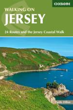
    Guidebook describing 24 day walks on Jersey in the Channel Isles. Parts of many routes can be combined to make longer routes, including the 48 mile Jersey Coastal Walk and part of the Channel Islands Way. Walks are between 3 and 8 miles, mainly on good paths and tracks, although occasionally rugged cliff paths explore the beautiful coastline.

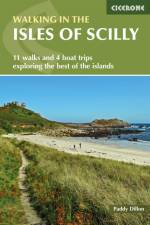
  • - 11 walks and 4 boat trips exploring the best of the islands
    av Paddy Dillon
    135

    This guidebook to walking on the Scilly Isles includes 11 day walks and 4 boat trips, perfect for a fortnight away from it all. The walks are between 1.5 and 10 miles long (2.5km and 16km), and explore the larger islands such as Tresco, St Martin's, St Mary's, St Agnes and Bryher as well as smaller islands in the archipelago. All routes are illustrated with OS mapping and contain lots of background information on the history, geology and ecology of the islands. There is also practical information on public transport services and accommodation. Alongside the walks, which are suitable for walkers of all abilities, are 4 boat trips which explore Annet and the Western Rocks, the Norrard Rocks, St Helens and Tean as well as the Eastern Isles. With their mild climate and relaxing atmosphere, the Isles make an ideal holiday destination, with stunning scenery, rich bird life and myriad wildflowers. Basking in sunshine, rising green and pleasant from the blue Atlantic Ocean, fringed by rugged cliffs and sandy beaches, they reveal their charms to those who walk the headlands, sail from island to island and take time to observe the sights, sounds and scents of the landscape.

  • - 50 walks in the National Park
    av Paddy Dillon
    185,-

    Guidebook describing 50 varied walks in England's beautiful North York Moors National Park. Showcasing the region's sweeping moorlands, sheltered valleys, woodlands and cliff coasts, routes range from short and easy low-level walks to long and strenuous routes across the high moors, including the Lyke Wake Walk.

  • - 1:25,000 OS Route Mapping
    av Paddy Dillon
    235,-

    Map of the 270 miles (435km) Pennine Way National Trail, between Edale in the Peak District and Kirk Yetholm in the Scottish Borders. This booklet is included with the Cicerone guidebook to the trail, and shows the full route on OS 1:25,000 maps. This popular long-distance route typically takes three weeks to complete.

  • Spara 11%
    - From Edale to Kirk Yetholm
    av Paddy Dillon
    215

    Guidebook to the Pennine Way National Trail with OS map booklet. The 270 mile route from Edale to Kirk Yetholm takes three weeks to walk and is suitable for fit and experienced long distance walkers. The route crosses the Peak District, Yorkshire Dales and North Pennines National Parks. Includes separate OS 1:25,000 map booklet of the route.

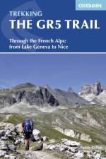
  • - Through the French Alps from Lake Geneva to Nice
    av Paddy Dillon
    249

    An essential guidebook for walking the GR5 trail, 660km from Lac Leman (Lake Geneva) to Nice or Menton, through the French Alps. Includes all the main variant routes as it passes Mont Blanc, then through the Vanoise, the Queyras and the Mercantour National Parks. Includes accommodation, profiles and maps. Suitable for fairly experienced hikers.

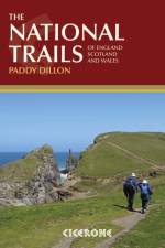
  • - 19 Long-Distance Routes through England, Scotland and Wales
    av Paddy Dillon
    275,-

    Inspirational guidebook to Britain's National Trails - 19 long-distance walking routes through England, Wales and Scotland. Together, these routes (National Trails in England and Wales and Scotland's Great Trails) cover well over 3100 miles (5000km), exploring the rich scenic and historic countryside of Britain. This larger-format guide explores the full breadth of the network, including the popular South West Coast Path, Hadrian's Wall Path, West Highland Way, Cotswold Way, Offa's Dyke Path, South Downs Way, Southern Upland Way and many others exploring the beauty and wild country of the British Isles. Outline schedules for each Trail allow you compare the routes and become inspired to take up the challenge, whether on a relatively short or easy trail, or to tackle a longer, more strenuous route. Basic day-by-day route descriptions for each Trail are illustrated with maps and profiles. Information is provided on access to and from the routes, maps, public transport, guidebooks, TICs, accommodation and useful websites.

  • - 50 Walks in England's remotest Area of Outstanding Natural Beauty
    av Paddy Dillon
    179

    A guidebook to day walks in the North Pennines Area of Outstanding Natural Beauty (AONB), across Cumbria, County Durham and Northumberland. The book includes 50 walks exploring England's 'last wilderness', ranging from 5 miles (8km) to 14 miles (23km). Most are circular, though there are some linear routes, and there is something to suit all abilities over a variety of terrain. Route descriptions are illustrated with OS mapping and colour photographs, and the book includes details of local transport services, accommodation and tourist information centres. The walks cover a variety of terrain, from flat railway trackbeds to pathless moorland, and provide the opportunity to explore the striking geological features and fascinating industrial heritage of the area.

Gör som tusentals andra bokälskare

Prenumerera på vårt nyhetsbrev för att få fantastiska erbjudanden och inspiration för din nästa läsning.