Marknadens största urval
Snabb leverans

Böcker av Norbert de Lange

Filter
Filter
Sortera efterSortera Populära
  • av Norbert de Lange
    959,-

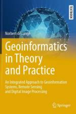
    This textbook is intended to display a broad, methodological introduction to geoinformatics and geoinformation science. It deals with the recording, modeling, processing and analysis as well as presenting and distributing of geodata. As an integrated approach it is dedicated to the multidisciplinary application of methods and concepts of computer science to solve spatial tasks. First the reader receives an introduction to the approach and tasks of geoinformatics, basic concepts and general principles of information processing as well as essentials of computer science. Then this textbook focuses on the following topics: spatial reference systems, digital spatial data, interoperability of spatial data, visualization of spatial information, data organization and database systems, geoinformation systems, remote sensing and digital image processing.The result is a comprehensive manual for studies and practical applications in geoinformatics. It serves also as a basis to support and deepen methodological courses in geography, geology, geodesy and surveying as well as all environmental sciences. In this first English edition, the author has updated and significantly expanded the fourth German edition. New additions include the development of apps, graphical presentation on the web, geodata-bases and recent methods of classification. This book is based on the original German 4th edition Geoinformatik in Theorie und Praxis by Norbert de Lange, published by Springer-Verlag GmbH Germany, part of Springer Nature in 2020 and still presents the only integrated perspective on geoinformatics and geoinformation science. This book was translated with the help of artificial intelligence (machine translation by the service DeepL.com) first and then significantly revised with regard to technical terms and special topics of geoinformatics.

  • av Norbert de Lange
    1 329,-

    This textbook is intended to display a broad, methodological introduction to geoinformatics and geoinformation science. It deals with the recording, modeling, processing and analysis as well as presenting and distributing of geodata. As an integrated approach it is dedicated to the multidisciplinary application of methods and concepts of computer science to solve spatial tasks. First the reader receives an introduction to the approach and tasks of geoinformatics, basic concepts and general principles of information processing as well as essentials of computer science. Then this textbook focuses on the following topics: spatial reference systems, digital spatial data, interoperability of spatial data, visualization of spatial information, data organization and database systems, geoinformation systems, remote sensing and digital image processing.The result is a comprehensive manual for studies and practical applications in geoinformatics. It serves also as a basis to support and deepen methodological courses in geography, geology, geodesy and surveying as well as all environmental sciences. In this first English edition, the author has updated and significantly expanded the fourth German edition. New additions include the development of apps, graphical presentation on the web, geodata-bases and recent methods of classification. This book is based on the original German 4th edition Geoinformatik in Theorie und Praxis by Norbert de Lange, published by Springer-Verlag GmbH Germany, part of Springer Nature in 2020 and still presents the only integrated perspective on geoinformatics and geoinformation science. This book was translated with the help of artificial intelligence (machine translation by the service DeepL.com) first and then significantly revised with regard to technical terms and special topics of geoinformatics.

  • - Grundlagen Von Geoinformationssystemen, Fernerkundung Und Digitaler Bildverarbeitung
    av Norbert de Lange
    1 035,-

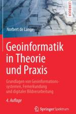
    Die Geoinformatik widmet sich der Entwicklung und Anwendung von Methoden und Konzepten der Informatik zur Lösung raumbezogener Fragestellungen unter besonderer Berücksichtigung des räumlichen Bezugs von Informationen. Sie beschäftigt sich mit der Erhebung oder Beschaffung, mit der Modellierung, mit der Aufbereitung und vor allem mit der Analyse sowie mit der Präsentation und der Verbreitung von Geodaten. Das Werk versteht sich als breit angelegte, methodische Einführung in die Geoinformatik. Behandelt werden zehn zentrale Gebiete:- Ansatz und Aufgaben der Geoinformatik - Grundbegriffe und allgemeine Grundlagen der Informationsverarbeitung- Grundlagen aus der Informatik- räumliche Objekte und Bezugssysteme- digitale räumliche Daten: Datengewinnung, Geobasisdaten und VGI- Standards und Interoperabilität von Geodaten- Visualisierung raumbezogener Informationen- Datenorganisation und Datenbanksysteme- Geoinformationssysteme- Fernerkundung und Digitale Bildverarbeitung.Entstanden ist ein umfassendes Handbuch für Studium und Praxis, das die Inhalte der Geoinformatik anwendungsbezogen zusammenführt und das darüber hinaus vielfältige Hintergrundinformationen liefert. Norbert de Lange hat die vorliegende vierte Auflage aktualisiert und wesentlich erweitert. Neu hinzugekommen sind Inhalte u.a. zur Entwicklung von Apps, zu graphischen Präsentationen im Web, zu Geodatenbanken und zu modernen Klassifikationsverfahren. Viele Beispiele wurden ergänzt, die aus Seminarveranstaltungen stammen und die sich zur Verdeutlichung der Methoden bewährten haben.Dieses Buch präsentiert noch immer die einzige integrierte Darstellung der Geoinformatik in deutscher Sprache.

Gör som tusentals andra bokälskare

Prenumerera på vårt nyhetsbrev för att få fantastiska erbjudanden och inspiration för din nästa läsning.