Marknadens största urval
Snabb leverans

Böcker i British Archaeological Reports International Series-serien

Filter
Filter
Sortera efterSortera Serieföljd
  • av Jennifer Mack, Joe Alan Artz, Liv Nilsson-Stutz, m.fl.
    1 015,-

    Edited by Katina T. Lillios, Anna J. Waterman, Jennifer Mack, Joe Alan Artz and Liv Nilsson-StutzThis volume presents the results of archaeological research conducted at the Late Neolithic-Early Bronze Age burial site of Bolores between 2007 and 2012, which built on work carried out in 1986. Bolores is a small site (5 x 3 m), yet the analysis of its structure and associated materials have yielded a rich and nuanced picture of a small population of people who lived, and died, in the third and second millennia BC in the Portuguese Estremadura. Although our research focused on the small-scale, it also attempted to bridge this perspective with the larger social and cultural dynamics at play during the time. It advocates, in its own way, for greater attention to the micro-scale: small sites, small objects, bone fragments, and details in ritual practice. In a time when Big Data, Big History, and global phenomena loom large in public and scholarly imagination, we think it is also important to understand the variegated texture of local, small-scale social practices, which, after all, are linked to broader sociocultural phenomena and hold the key to understanding resistance and social change.

  • av Freda Nkirote M'Mbogori
    845,-

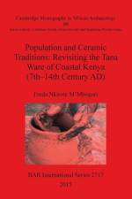
    Cambridge Monographs in African Archaeology 89This research is a departure from the traditional archaeological pottery analysis in Kenya, where emphasis has been on decorations and forms. It uses a technological approach to offer additional information on Bantu pottery. Pottery decorations and forms are still powerful instruments in defining the spatial and temporal distributions of prehistoric populations, but the ability of these attributes to mark social boundaries is limited by their obvious visibility on the finished product. Whilst this explicit visibility is an advantage for archaeologists who seek to explore temporal and spatial distributions of different wares, it is problematic, since it is possible for socially, ethnically, and linguistically distinct communities to copy from each other, making salient pottery features unreliable indicators of social boundaries. Therefore, this study emphasises the production stage, which is not as obvious on the finished product and must be learnt by apprenticeship only through kinship. This study sought to establish the social boundaries for makers of Tana ware; an Iron Age pottery attributed by some to Bantu speakers, whilst others attribute it to Cushitic speakers. Chaîne opératoire was used as an analytical tool for archaeological data collected from Manda and Ungwana site assemblages. Ethnographic reference data was collected from Cushitic and Bantu speakers from the Coastal and Highland regions of Kenya. Ethno-historical data was derived from library resources, while experimental data were obtained from the field.

  • - Sylvanus G. Morley 1946
     
    639,-

    Chichén Itzá is a UNESCO-designated World Heritage site, one of the largest and most accessible Maya archaeological areas in southern Mexico. The densely clustered architecture of the site core covers an area of at least 6.5 square kilometres, and smaller scale residential architecture extends for an unknown distance beyond the site core. Although the history of archaeological study of the site extends back over a century, the most significant and productive effort was that directed between 1924 and 1940 by Sylvanus G. Morley under the sponsorship of the Carnegie Institution of Washington. Morley prepared a draft of a Guide Book to the Ruins of Chichén Itzá in 1946, which has since languished in the archaeological archives. Although dated and probably quaint by modern standards, Morley's guide to Chichén Itzá remains the only synthesis of the site based on almost 20 years of excavation, consolidation, and restoration of the ruins. Our interest in publishing Morley's manuscript was based on several factors: it was Morley's last written work; it was the only synthesis of Morley's work on Chichén Itzá; and, quite simply, it is a work important to the history of the study of Maya archaeology. Several modifications have been made to the manuscript. We have attempted to leave as much of the original text as written by Morley. Sections that have been corrected by more recent research are amended and included as notes. Repetitious text has been removed and obvious errors in spelling and punctuation have been corrected. Notes have been added by the editors to explain or amplify statements in the manuscript. In addition, written commentary on the original manuscript by Karl Ruppert has been included as notes.

  • - Papers arising from 'Exploring Human Origins: Exciting Discoveries at the Start of the 21st Century' Manchester 2013
     
    1 059,-

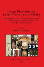
    The present volume is based on research articles submitted as part of an international conference Exploring Human Origins: Exciting discoveries at the start of the 21st Century', 5-10 August 2013 in Manchester, UK, under the auspices of the International Union of the Anthropological and Ethnological Sciences (IUAES). The main focus of these papers was to record the more recent fossil, archaeological and genomic discoveries in the field of human origins and evolution, besides a few very significant ones made in 1990s. This volume presents the findings of various researchers that highlight different perspectives contributing to the greater understanding of human origins and ongoing evolution.

  • - Proceedings of the SEAC 2011 conference
     
    1 325,-

    Edited by F. Pimenta, N. Ribeiro, F. Silva, N. Campion, A Joaquinito and L. Tirapicos.Proceedings of the SEAC 2011 conference.Since Prehistory, the sky has always been integrated as part of the cosmovision of human societies. The sky played a fundamental role not only in the orientation of space, time organization, ritual practices or celestial divination, but also as an element of power. Migrations and voyages are intrinsic to humankind, they opened the routes for cultural diffusion and trade, but also for power dominance. Following these routes is also to follow cultural diversity and how human societies met or clashed. The sky and astronomical phenomena provided the tools for time reckoning, calendar organization and celestial navigation that supported those voyages. Astronomy today gives us the capacity to reproduce the sky, opening a window through which we can glimpse how those societies perceived, integrated and manipulated the sky into their world-views and their myths and, ultimately, into their social organization. The papers presented in this volume were submitted after the 19th meeting of the European Society for Astronomy in Culture, Évora, Portugal, 19th-23rd September, 2011.

  • - Quarta campagna di indagini sulle strutture rupestri / Fourth campaign of surveys on the underground structures
     
    1 235,-

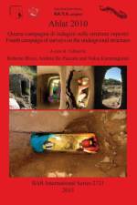
    La quarta spedizione di ricerca sulle strutture sotterranee di Ahlat (Turchia sud-orientale), nel 2010, si è sviluppata su quattro obiettivi principali che hanno aggiunto nuove significative conoscenze sull'habitat rupestre di questa vasta area vulcanica.La parziale asportazione dei sedimenti che occludono un lungo cu-nicolo sta rivelando un articolato reticolo ipogeo con interessanti prospettive su sviluppo, funzioni e tecnichedi scavo. L'individuazione di un quarto acquedotto sotterraneo e la probabile localizzazione della tomba diun martire cristiano del XV secolo in zone rupestri periferiche, si aggiungono a ulteriori ritrovamenti nel cuore stesso dell'area archeologica: un pozzo, diverse cavità adibite a depositi agricoli, un edificio interrato(zecca), una neviera, iscrizioni lapidee, ecc.The fourth research expedition on the underground structures of Ahlat (south-eastern Turkey), in 2010, developed on four main targets that added significant new knowledge about the rocky habitat of this wide volcanic area. The partial removal of sediments that occlude a long tunnel reveal an underground complex network with interesting perspectives about development, functions and excavation techniques. The identification of a fourth underground aqueduct and the probable location of the tomb of a fifteenth century Christian martyr in rocky peripheral areas, join to other findings in the very heart of the archaeological area: a shaft, many cavities used as farm-storage, a buried building (mint), a snow-house, tombstone inscriptions, etc.

  • av Judit Lopez de Heredia Martinez de Sabarte
    1 175,-

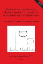
    This doctoral thesis is a study of the development of pottery production in the communities of the Second Iron Age that settled in what is now the area encompassing the Basque Country. Three sites, Los Castros de Lastra, Basagain and Munoaundi, are fortified settlements on hilltops, while Santiagomendi is an unfortified settlement and the fortified settlement of La Hoya is located on a plain, with a highly developed urban area. As a starting point, a comprehensive and integrated approach was sought to bring together a typological and morphological approach towards the collections, including decorative aspects as well as an assessment of the technological and functional standards of the pieces. To this end, as a theoretical basis, the concept of chaîne opératoire has been employed as a theoretical framework, within which different methods of approaching the pottery including morphological study, macroscopic description, archaeometry, experimental archaeology and ethnoarchaeological coverage.

  • - Una historia de colonialismo economico de principios del siglo XX
    av Juan Manuel Cano Sanchiz
    1 079,-

    Cerro Muriano is a small population centre situated 16 km to the north of the city of Córdoba, between the municipalities of Córdoba and Obejo (Andalusia, Spain). This territory is situated over a large field of copper veins, which has been exploited by the different peoples and societies that have populated Córdoba's mountain range Sierra Morena. The mining and metallurgy of this red metal have been used to track the evolution of this site over time. This has produced much archaeological evidence, ranging from the Copper Age to the 20th century. From 1897 to 1919, the mines of Cerro Muriano were worked -with the new technologies brought by industrialisation- by four different, but closely related, English companies. These companies generated a complete mining settlement; a plant of considerable dimensions for washing and concentrating the minerals, calcining them, smelting them, and finally converting the matte into blister copper; and a populated complex of various neighbourhoods composed of houses, shacks and barracks. In addition, there was other infrastructure required to sustain a society (e.g., a school, canteen, theatre, church, hospital, etc.), buildings for work (e.g., offices and a laboratory), and other spaces for production, storage, and distribution. It was specifically the train that connected the city of Córdoba with the coal-mining area of Peñarroya-Belmez-Espiel which permitted the English to set up their business in a mountainous location. However, at the end of the 19th century, the train did not stop at Cerro Muriano; in fact, there was nothing to motivate the construction of a train station there: neither a consolidated population nor any important economic activity. Thus, one of the primary objectives of the initial English capitalinvestment was to bring the rail line to its properties. Therefore, mining and railways marked the origin of Cerro Muriano as we know it today. This study case of Cerro Muriano during the English period found that it was a faithful reflection of its time. Spanish mining in the late nineteenth and early twentieth centuries was heavily influenced by the involvement of foreign companies. This should not be seen as a distinctive feature of Spain as a whole, but rather as the result of an international situation in which mining underwent a kind of premature globalisation. It may be argued that the British Cerro Muriano was a standard product. In it, we can discern many of the features typical of the international expansion and industrialisation of mining and metallurgy operations: the key introduction of new technology in the exploitation of the mine, the fundamental importance of the railway, the eclectic nature of the whole in terms of the technology employed, and the creation of a mining village, in the town- planning and social senses. In short, Cerro Muriano is a good example of economically-colonialist mining activity that seems to show that the highly topical subject of globalization is not a new phenomenon, since the evolution of technology and the spread use of the same machines on an international scale -among other circumstances- facilitated the homogenization of the world we inhabit today.

  • - Landscape in the Ason river valley (Spain) during the Final Late Glacial: a predictive vegetation model using GIS
    av Alejandro Garcia Moreno
    529,-

    RESUMEN El final del Pleistoceno en la Región Cantábrica (norte de la Península Ibérica) es testigo de una serie de importantes transformaciones ambientales, sociales y culturales. Desde el punto de vista climático y ambiental, el Tardiglaciar se caracteriza por una gran inestabilidad, y supone a grandes rasgos el fin de unas condiciones glaciares y la transición a otras más templadas y húmedas. Esto conlleva el desarrollo de masas forestales caducifolias, principalmente de robledales y bosques mixtos atlánticos, que van desplazando los bosques de pinos dominantes durante el Würm. La progresiva sustitución de bosques de coníferas por otros caducifolios pudo haber influido en los cambios económicos y la organización social de las sociedades del final del Paleolítico. En este trabajo, se analizan los cambios en el paisaje del valle del río Asón (Cantabria) a lo largo del Tardiglaciar. Para ello, se ha desarrollado, mediante el empleo de un Sistema de Información Geográfica (SIG), un modelo predictivo de distribución potencial de la vegetación arbórea. Este modelo, basado en los requerimientos ecológicos de las principales taxa arbóreos identificados en los diagramas políticos de la región, estima las áreas donde mayor probabilidad de desarrollo tendría cada especie. Los resultados obtenidos permiten comprobar un importante cambio en la distribución espacial de las principales masas forestales a lo largo del Tardiglaciar y del Holoceno inicial. Este cambio en el paisaje, y por lo tanto en la distribución de los recursos asociados a los bosques caducifolios, pudo haber influido en los cambios observados en las estrategias de subsistencia y los patrones de asentamiento de los grupos de cazadores y recolectores del Magdaleniense Superior y el Aziliense.ABSTRACT The end of the Pleistocene in the Cantabrian Region (northern Iberia) witnesses a series of major environmental, social and cultural changes. From a climatic and environmental point of view, the Lateglacial is characterized by a high instability, and broadly means the transition from glacial to warmer and milder conditions. This transition implies the development of deciduous forests, mainly oakwoods and Atlantic mixed forests, which displaced the pine forests dominant during the Würm glaciation. The continual substitution of conifers by deciduous forests might have had an influence on the changes in the economy and the social organization of Late Palaeolithic societies. In this work, changes in the landscape of the Asón river valley (Cantabria) during the Lateglacial are analysed. To do this, a GIS-based predictive model for the potential distribution of tree vegetation was developed. This model, based on the ecological requirements of the main taxa identified in pollen diagrams from the region, estimates the areas where each species could have had higher probabilities to develop. The results obtained allow verifying an important change in the spatial distribution of the main forest types during the Lateglacial and the early Holocene. This change in the landscape, and therefore in the distribution of the resources related to deciduous forests, might have had an influenced in the changes observed in the subsistence strategies and the settlement patterns of Upper Magdalenian and Azilian hunter and gatherer communities.

  • - Current Perspectives from Archaeology, Epigraphy, History and Chronology: Proceedings of the Third BICANE Colloquium held at Sidney Sussex College, Cambridge 26-27 March 2011
     
    1 175,-

    A collection of papers presented at the Third BICANE Colloquium held at Sidney Sussex College, Cambridge in March of 2011.

  • av Geoff W Adams
    829,-

    One of the most significant features in the suburbium of Roman cities throughout Italy were the villae suburbanae. Modern scholarship has undertaken a large amount of research into the residential properties and lifestyles of the Roman nobility, and the Roman villa has been a prime subject area in this regard. But villae suburbanae have only received limited detailed analysis from these scholars. To this end, this study examines both the literary and archaeological evidence relating to villae suburbanae in an effort to gain a better understanding of this type of residence. The first fundamental feature of this investigation is to understand these buildings within their social and geographical context. The second feature is the method employed to interpret the social aspects of villae suburbanae, which utilises statistical analysis to determine the percentage of space allocated for potential entertainment. This dual approach makes the study both historically relevant for a more comprehensive analysis of villae suburbanae, and methodologically innovative as it introduces a new methodology for analysing floor plans of residences, which should be applicable to other types of structure in future investigations.

  • av J. Ruiz Cobo & E. Munoz Fernandez
    1 425,-

    This book presents the rich and varied archaeological record from excavations carried out between 2004-2010 in the Saja river basin, Cantabria, northern Spain.

  •  
    829,-

    This book is timely. As the contributions in it illustrate, 2D and 3D modeling of cultural heritage is no longer used just to illustrate the location and appearance (past or present) of archaeological sites, but also as a tool to discover and recover data from archaeological remains. There are better ways of predicting where this data might be found under the surface. When applied to the legacy excavation data of a cultural heritage site -or when used to record the progress of a new excavation, 3D modeling has the potential to mitigate the irreversible and destructive nature of archaeological excavation, an unfortunate, ironic, and unavoidable central fact of archaeology as traditionally practiced. With the widespread adoption of 3D technologies to record and reconstruct archaeological sites, the archaeologist can virtually preserve the site through 3D data capture as we dig it up. And, once the 3D data gathered in the field has been modeled, it is possible to retrace decisions and test the validity of conclusions with more precision and confidence.

  • - Finds from Raymond-Charles Weill's excavations in 1914 and 1921
    av Othmar Keel, Nachum Applbaum, Dan Barag, m.fl.
    625,-

    The ancient site of Tel Gezer (Abu-Shûsheh/Tell Jezer/Tell el-Jazari) is located in Central Israel, approximately halfway between Jerusalem and Tel Aviv. It is situated in the northern section of the Judean foothills (Shephelah), not far from the southernmost hills of south-western Samaria. Raymond-Charles Weill commenced his career in archaeology and Egyptology at a relatively late age. After receiving his training in Egyptology and archaeology in France, Baron Rothschild invited him to excavate in Jerusalem, on lands belonging to the Baron. These excavations were conducted both before (in 1913-1914) and after (in 1923-1924) the First World War, and were duly reported by Weill (1920; 1947). Apparently, ancient tombs had been revealed on the site by the settlers, and Weill, who by chance was excavating at the time for the Baron in Jerusalem, was called in to excavate at Gezer. Both seasons of Weill's excavations at Gezer (in 1914 and 1924) coincided with his work in Jerusalem. His results were never fully published, and this present volume represents the author's long researches to make some of Weill's discoveries more widely available. With contributions by Nava Panitz-Cohen, Dan Barag, Othmar Keel, Nachum Applbaum and Yaakov H. Applbaum

  •  
    1 739,-

    Recent studies on the Anatolian archaeology in this volume shows the great importance of the cultural and archaeological heritage of the Turkey. This volume includes data from surveys and excavations, in addition to the analysis of unpublished materials preserved in local museums. The geographical region covered in by the papers included in this volume covers the whole of Asia Minor, from the west coast to the central and northern part, up to the east. The temporal coverage ranges from the Neolithic to the nineteenth century. Scholars from various parts of the world, but especially young and promising Turkish researchers, have contributed papers to this volume which discuss the important archaeological heritage of Anatolia and contribute a great deal to archaeological knowledge and practice in this part of the world.Edited by Ergün Lafl¿ and Sami Patac¿ with the assistance of Gonca Cankarde¿-¿enol, Ahmet Kaan ¿enol and Gülseren Kan ¿ahin.

  • - Trade routes of the Near East in Antiquity
     
    859,-

    This book is the result of a large-scale research undertaking Trade Routes of the Near East", examining Egyptian-Levantine interaction in the 4th Millennium BC. Chapters explore many issues related to copper and trade in the long period covering the Chalcolithic and Bronze Ages, but also Roman period, with a special extension to present metallurgical practices in the African interior. A wide range of data discussed here was collected from across the eastern Mediterranean region including Egypt, Jordan, Cyprus and Greece.

  • - An interpretation of funerary results
    av Li Sang
    909,-

    The Middle Euphrates Region, encompassing ancient Syria, enjoyed a period of rapid and complex socio-political development during the third millennium BC. These developments are archaeologically reflected in changes to burials and funerary rituals during this time. This important category of evidence lay largely unexcavated until large-scale dam construction prompted a series of rescue excavations across the region during the latter half of the twentieth century. This in-depth study of the mortuary remains from several sites on the Middle Euphrates presents the material from these and earlier excavations in a single, comprehensive volume for the first time. It uses this material to investigate the multifaceted world of third millennium funerary ritual and cult. The author provides original and informative conclusions about funerary rituals and their possible significance to society in ancient Syria, making this book an invaluable resource for researching the Early Bronze Age activity in the Middle Euphrates Region.

  • - Second Arheoinvest Symposium: From the ethnoarchaeology to the anthropology of salt 20-21 April 2012, 'Al. I. Cuza' University, Iasi, Romania
     
    1 155,-

    Salt is a biological and social necessity to human life. Salt has played a significant role in many ancient and modern processes, such as trade, preservation, health and cooking, which in turn makes the production, trade, transport and use of salt visible both in archaeological and historical evidence. This volume presents the papers of the Second Archeoinvest Symposium, From the ethnoarchaeology to the anthropology of salt (2012), held at the University of Iäi, Romania. Many of the papers focus on theanthropology of salt in Romania, home of some of the oldest salt mines in the world and to an ancient and ongoing tradition of salt extraction and use. Also included are papers on evidence for salt use in other geographical regions including Mesopotamia,the Classical World and South America. Further, a selection of papers discuss the use of salt topically, such as the role of salt in magic and medicine, for example. The papers encompass a large chronological span from the Neolithic to the twentieth century. Papers draw on a range of disciplines including archaeology, ethnography, anthropology, medicine, geography, geology. This volume presents a fascinating and unique range of approaches for studying a ubiquitous and vitally important resource in past and present societies.

  •  
    1 499,-

    The study of ceramics, their movement and their changes over time is one of the most significant and fruitful areas of historical archaeology. Nonetheless, a gap in the research is evident from the limited number of projects embracing archaeometrical methodologies. This volume, consisting of several of the papers given at GlobalPottery - 1st International Congress on Historical Archaeology and Archaeometry for Societies in Contact (2012) and further invited contributions, provides a wealth of research and data to help fill this gap. The conference focussed on ceramics of the Early Modern Period, taking a truly global perspective, with sessions on Europe, the Americas, and the Indian and Pacific Oceans. Each paper provides detailed scientific analyses of ceramic evidence, contextualised into historical and social narratives. These papers shed light on the effect societies have on one another when they come into contact, a particularly stimulating topic for a period which saw the European colonisation of the Americas and the first circumnavigations of the world. Throughout the volume, scientific and stylistic analyses are combined to aid our understanding of the transmission of ideas and methods of ceramic technology in this period of increasing connectivity across vast distances. English and Spanish language papers include detailed illustrations and maps along with tabular data and graphs. Owing to its highly interdisciplinary nature, this volume is of interest to those studying a wide range of topics including archaeometry, ceramics, Early Modern archaeology and geographical connectivity.

  • - Studies in the topography of passage in ancient Egyptian religious literature
    av Eltayeb Sayed Abbas
    589,-

    This research is an investigation into the safe passage of the deceased over water as exemplified in the early Egyptian legends involving the 'Lake of Knives' and the 'Lake of Fire'. The journey of the deceased from death to resurrection is envisaged as taking place in a boat crossing dangerous places and ordeals. This journey was parallel to the sun god Re's passage over the waters of the sky, and in which he is threatened by the powers of chaos. The rites of passage focus on the safe passage of Re through chaos, and assert resurrection, rebirth and life after death for the deceased. The passage is re-enacted in mythical images and in ritual actions, and focuses on the safe journey of the deceased through the ordeals of the Netherworld. This research is divided into seven chapters. Chapter One deals with the symbolism of water, knives and fire. Water is dealt with as the discharge which comes from the body of Osiris and offered to him in ritual. The second section deals with the symbolism of knives and fire. It is concluded that water mediates the passage of the deceased when it is offered to him in ritual. Water can also cause violent death. Fire and knives are used as destructive tools in rituals. Chapter Two explores the cartographical descriptions and cosmographical locations of the two lakes, using textual and pictorial evidence. It is concluded that the Lake of Knives is envisaged as extending from the east to the west of the sky. The description of the Lake of Fire varies from one context to another. The two lakes have no specific locations, but they wind through the sky. Chapter Three is a discussion on the theme of passage over water in Ancient Egypt. The ferryman spells and the Island of Fire are taken as two examples for the passage of the deceased over water. It is concluded that the ritual aspects of the ferryman spells and the Island of Fire are not very different from the ritual aspects of the Lake of Knives and the Lake of Fire. Chapter Four is an extension of the discussion of the theme of passage over water, and deals with crossing the lake as a ritual enacted for the deceased at the day of funeral. It is tentatively concluded that the aim of the deceased's crossing over the lake is to mediate his passage to become an Ax. The crossing was accompanied by recitation of ritual texts. Crossing over the Lake of Knives and the Lake of Fire was also accompanied by recitations of ritual texts. Chapter Five deals with the Lake of Fire in the Book of the Two Ways. The journey of the deceased is constructed until he reaches the Lake of Fire. It is concluded that the Lake of Fire is a place, which the deceased visits to be reborn in the morning and starts a new journey towards the abode of Osiris on the upper waterway. Chapter Six investigates the rites of passage concerning the crossing over the two lakes. It deals also with the handling of symbols within the rituals performed for the deceased. It is concluded that the Lake of Knives and the Lake of Fire are two metaphorical places that do not exist in rituals. They do not have fixed physical locations, but they exist in myth. Crossing over the two lakes is dangerous, but is also necessary for the deceased to continue his journey and to enter into a different status, status of being an Ax. Chapter Seven draws answers for the questions of the aim of the deceased's crossing over the two lakes. It is concluded that the aim of the deceased's journey over the two lakes differs from one context to another. It is also explicit that there is no single specific explanation for the rites of passage over the two lakes, and they draw on different metaphors.

  • - Perspectives across disciplines
     
    705,-

    This publication has its origin in the colloquium Animals and Otherness in the Middle Ages held at the Faculty of Geography and History at Complutense University in Madrid in February 2011. This publication aims to bring together scholars from a range of disciplines to consider the diverse use of animals in constructions of 'otherness'. It encompasses not only conceptualized difference, but also physical societal differences expressed in the varied treatment of real and imagined animals. The contributions also discuss the use of animals to emphasize contrast more broadly, such as the juxtaposition between good and evil, or positive and negative features.

  •  
    795,-

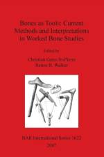
    The papers in this volume were originally collected for a symposium entitled Recent Developments in Bone Tool Studies, organized for the 69th annual meeting of the Society for American Archaeology held in Montreal (Canada) on April 2nd, 2004.

  • - Proceedings of a conference at Coalbrookdale, 4-7th May 2006 hosted by the Ironbridge Institute
     
    705,-

    Proceedings of a conference at Coalbrookdale, 4-7th May 2006 hosted by the Ironbridge InstituteThis book includes papers presented at a conference on World Heritage management held at Coalbrookdale, Shropshire, England in May 2006. hosted by the Ironbridge Institute.

  • - Late Pleistocene rockshelters and an open-air site
    av Halawathage Nimal Perera
    1 175,-

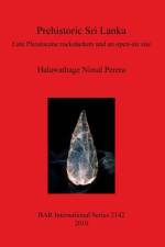
    Sri Lanka is a tropical island that lies approximately halfway between Africa and Australia along the northern rim of the Indian Ocean, and has one of the best recorded prehistoric sequences in South Asia. A review of its prehistory is a vast subject. The present study investigates the island's hunter-gatherer archaeology between the Late Pleistocene and the middle Holocene, with lowland Wet Zone rockshelters as the principle topic of study. This work synthesises past and current archaeological research in the island as well as presenting new findings from excavations in the Batadomba-lena rockshelter and the open-air site of Bellan-bandi Palassa. The excavation of Batadomba-lena has provided fresh data for understanding human adaptations to the changing environment between approximately 36,000 and 12,000 years ago. A rainforest environment evidently persisted throughout this period in the environs of the site, but the climate was cooler at around the Last Glacial Maximum. Intensive occupation, succeeded by increased attention to the management of plant resources, followed the Last Glacial Maximum. Microliths, small tools defined by the presence of blunting retouch, as well as the bifacially trimmed Balangoda Point and polished bone points, were evident from the earliest occupation. The symbolic capacities of the inhabitants were also revealed through the recovery of ornaments and ochre fragments throughout the sequence. The Batadomba-lena sequence has important implications for the Out-of-Africa theory on modern human origins, as well as Sri Lanka's recognition of its cultural heritage.

  •  
    1 019,-

    The articles in this volume cover aspects relating to archaeometallurgy, functional analyses, experimental work and archaeology and focus on multidisciplinary approaches for studying archaeological artefacts.

  • av Knut Andreas Bergsvik
    1 205,-

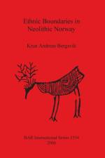
    During the transition to the early Neolithic, a number of changes took place among the hunter-fishers of southern Norway. New resources were exploited, and some groups took up agriculture. Several new artefacts were invented and more lithic raw materials were quarried. People became increasingly sedentary and distinctive regional traditions developed. At the same time, long distance trade was initiated between these regions. The fact that the changes happened more or less simultaneously in many regions was probably not coincidental. They were, most likely, intimately linked to changes that also took place in the social lives of these people. One of the most important social changes may have been the development of more marked ethnic boundaries, which were related to increasing social inequality among the local groups. Such boundaries are important because they enable control of own populations and because they increase the social status for the ones who are able to cross them. In this study, the main theme is the investigation of whether such ethnic boundaries can be delineated. The author identifies them archaeologically, and discusses how and why they were established and maintained. Cultural differences are important resources for the establishment of ethnic differences. Consequently, it is of vital importance to investigate whether such differences can be traced in the archaeological data. This is done by recording as many early Neolithic cultural practices as possible and by subjecting them to a multivariate analysis. The author documents and quantifies site locations, raw materials, tool types and lithic reduction techniques to decide whether the distributions on these practices co-vary across space. The author also investigates whether there have been ruptures or major changes in communication. This is done by recording the distribution of the lithic raw materials with known sources. Although the development of more marked social boundaries probably took place throughout southern Norway, the main area of analysis in this volume only includes western Norway between Sunnmøre and Hordaland, and the mountain range between eastern and western Norway. Regions adjacent to this area are, however, drawn into the analysis and discussions. The most importantdata is from 37 excavated early Neolithic sites, which have been selected and re-analysed by means of a reference system for raw materials for the purpose of this study. Geological isotope analysis and mineralogical studies are important elements of the investigation of the lithic data. The study concentrates on the early Neolithic, which is approximately dated to between 5200 and 4700 BP in western Norway and 5100 and 4500 BP in eastern Norway. The late Mesolithic is, however, referred to both as a contrast to, and as a historical background for, the boundaries that emerged during the Neolithic.

  • av Roland de Beauclair
    1 095,-

    Neolithic cultural groups are traditionally determined on the basis of pottery distribution, and ceramic clusters have therefore been conflated with cultural ones. Though there has been general acknowledgement of the methodological and theoretical problems with this practice, it is still common. This volume aims to find a solution to this problem, by investigating this topic using burial customs. It includes data from nearly five hundred burials at fifty sites around the Mediterranean, thus providing wide-ranging but detailed evidence. The funerary evidence is presented in a thorough catalogue along with several maps and illustrations. The author, using spatial analysis, then combines his findings with the more traditional conclusions taken from ceramic evidence to provide a more nuanced set of conclusions. It thus provides a dynamic and detailed account of the complexities of Neolithic society in southern Europe.

  • - Atti III Congresso Nazionale di Archeologia del Sottosuolo: Massa 5-7 Ottobre 2007.
     
    1 375,-

    HYPOGEAN ARCHAEOLOGY: Research and Documentation of Underground StructuresEdited under the Aegis of the Federazione Nazionale Cavità Artificiali (F.N.C.A.): No 6Atti III Congresso Nazionale di Archeologia del Sottosuolo: Massa 5-7 Ottobre 2007The study and registration of artificial cavities means the documentation of underground structures. Just as Man started creating buildings on the surface of the Earth, over the course of time, he also perforated the surface thus creating new spaces and handing down structures which are essentially intact, which can be studied, restored and even utilised. In fact there exists an underground heritage, consisting of structures both built and buried underground over the passing of time. The interpretation and understanding of such structures is a source of interesting information on our past, in favour of the present. This series was created under the aegis of the Federazione Nazionale Cavità Artificiali (F.N.C.A.). The aim is to create a base for the disclosure of relevant, scientific research studies, whether monographs, the works of various authors or documentation from conferences and conventions and a series of easily consultable tools for the development of artificial cavity research.Translations by Federica Barna and Sara Bianchi

  • av Efraim Lev
    709,-

    Jerusalem has always been a unique city. Hundreds of millions of people, believers of the three main monotheistic religions Christianity, Islam and Judaism, have always looked forward to visiting, living, dying or even being buried in the Holy City. Throughout its long history, this city was subject to different kings, sultans and leaders that ruled the city and its inhabitants. Simultaneously, the population of the city changed in origin, habitat, language, culture, and in other aspects of life such as quality of the medical system, physicians and remedies that were used. This book is a reflection of the growing academic interest in the history of this fascinating city in general and of medicine in Jerusalem in particular. The interest that the academic community has had in the subject of medicine in the holy city can be measured by the number of articles and books that have been published, academic courses and seminars that have been taught and conventions that have been held in various academic institutes in Israel. The book deals with natural curative substances and healing materials used by the residents of Jerusalem throughout the ages, but its scope takes in the use of materia medica in the Land of Israel and throughout the Levant in this timespan. The study represents an intensive and systematic historical study of the medicinal substances that were used by the inhabitants and the visitors of the City of Jerusalem. It deals with the description of the various substances and their uses. It also deals with comparisons of such uses in traditional and folk medicine of several ethnic groups of present day in the region and in other parts of the world. Part A covers the information gathered from different historical sources of the medieval and early Ottoman periods (10th-18th centuries. Part B refers to specific subject matters including institutes and historical periods that deserve special attention concerning the uses of medicinal substances in the city of Jerusalem (including chapters on traditional and folk medicine substances still used in Jerusalem as well a modern overview. Three appendices provide information concerning the historical periods dealt with in the book, the sources, which are mentioned and quoted in Part A, and a list of medicinal substances used in Jerusalem from the 10th to the 18th century. A bibliography, list of abbreviations, and indices conclude the study.Translated by Rebecca Toueg

  • - Carta archeologica
    av Luca Donnini & Lorena Rosi Bonci
    949,-

    Notebooks on Medieval Topography (Documentary and Field Research) No 8

Gör som tusentals andra bokälskare

Prenumerera på vårt nyhetsbrev för att få fantastiska erbjudanden och inspiration för din nästa läsning.