Marknadens största urval
Snabb leverans

Böcker i British Archaeological Reports British Series-serien

Filter
Filter
Sortera efterSortera Serieföljd
  • av Sue Harrington
    539,-

    In this volume, the author examines the woodland banking in the parish of Cudham on the North Downs (to the south of the Greater London region) to establish the phases of expansion and contraction of the woodlands in the Medieval period. An anomaly was evident between the Domesday Book reference suggesting extensive ploughlands and a post-Medieval reference suggesting extensive woodlands. Synthesis of the evidence from a sampling survey of the banking, the place-name evidence and from documentary sources suggested changes in the land use and settlement patterns, with the woodlands consistently prominent through all periods. The extant banking is thought to relate to the earliest Medieval settlement of the parish, which probably took the form of bounded estates. Their later use as woodland banks has preserved them in the landscape. Early Medieval use of the landscape for transhumant pasturing, followed by a dispersed settlement in the woodlands, led to a limited, arable, open field system in the later Medieval period. Non-manorial land tenure was characterised by renting, indicating the ability to generate income through the sale of surplus woodland products. The post-Medieval period is characterised by privately-owned woodland compartments. The conclusion is drawn that, over time, Cudham has been maintained as a specialised, woodland resource-producing area in the hinterland of London.

  • - Traditions of Construction and Use
    av Rick Peterson
    939,-

    This work uses what is known about the Neolithic (4000-2400 BC) pottery of Wales to create a history of the meaning and use of that material. It is divided into two parts. In a thought-provoking and original first section, the author deals with some aspects of the history of archaeology, philosophy and science, and attempts to draw these ideas together into a methodology suited to explaining the pottery of Neolithic Wales. The second section employs this methodology to tell the story of the pottery, studying examples from Llugwy in Anglesey to Tinkinswood on the Glamorgan coast. The work concludes with two detailed Appendices, tabling radiocarbon evidence and a summary of pottery traditions.

  • - Archaeology and interpretation in early 21st century Britain. Proceedings of a session from the 2001 Institute of Field Archaeologists annual conference, held at the University of Newcastle upon Tyne
     
    539,-

    Proceedings of a session from the 2001 Institute of Field Archaeologists annual conference, held at the University of Newcastle upon TyneThis volume is based on a session entitled 'Interpreting the Ambiguous' at the 2001 Institute of Field Archaeologists (IFA) annual conference at the University of Newcastle upon Tyne. It is hoped that the 13 papers will be of value to anyone planning archaeological interpretation work in the near future. They range over large expanses of both space and time. While they vary considerably in terms of subject matter, they are all united by one basic aim: the desire to encourage people to think for themselves about the past.

  • av Susann Palmer & Denene Reilly
    695,-

    This report involves a multi-period site in a corner of the large sports field of the Royal Manor Arts College in Weston Road, Portland (Dorset, southern England). Excavation took place following the proposed development of an all-weather sports field, which was shown to contain many structures and other remains during preliminary assessment work by commercial archaeologists. The on-site work took place over a period of about 15 months. A large number of features and a very large quantity of finds were revealed. Specialists in different fields have contributed to the study of the main categories of finds and numerous photographs and drawings give a clear indication of the interest of the site and its assemblages.With contributions by Joanna Bird, Malcolm Lyne, Christopher Sparey-Green, Mark Maltby, Michael Allen, Debra Costen, Jane Yeo, David Ashford and David Dungworth

  • av Chris Fenton-Thomas
    1 159,-

    This study looks at the changing landscape of the Yorkshire Wolds from the Late Bronze Age up until the period prior to the Norman Conquest. This is a very large area so only a small section of this is studied in depth, namely the central Wolds area to the west of Driffield, which today encompasses eight modern parishes. This area has several different types of landscape commonly present in the Wolds: rolling countryside, broad sweeping valleys, springhead streams, the high dissected western Wolds, the western margins of the Wolds, and the high central Wolds watershed. This area includes all general topographies found in the Wolds and and therefore acts as a sample zone for comparisons between these different landscapes. The study starts by looking at this area during the Late Bronze Age, and this was when large areas of land were enclosed by linear earthworks comprising ditches, banks and walls. Fenton-Thomas looks at the origins of these linear ditches, and outlines the roles that these earthworks played. The study then goes on to look at the early and middle Iron Age periods, which were contemporary with square barrow cemeteries, and this period had an open and mobile landscape. The later period of the Iron Age was more occupied and enclosed, and this period prior to the Roman conquest was one of change, when the Wolds were an area of mainly pastureland which was separate from the lowland areas. Fenton-Thomas looks at the historical evidence from the twenty towns from the detailed study area, with the aim of finding out what the landscape was like before parliamentary enclosure. He then goes on to give an overview of the Wolds landscape before the Norman Conquest, using both historical and archaeological evidence. The picture emerges of an open and unenclosed landscape criss-crossed by trackways, which helped to structure township boundaries. During the medieval and post-medieval periods the large common field systems that existed can be seen, especially from place-names. Enclosures became more and more common as the Anglo-Scandinavian period began. Fenton-Thomas sums up his study by taking an overall perspective of the whole period, stressing the pattern of continuity and change that occurred, with periods of relative stability being followed by those of 'radical transformation'. The periodical isolation of the Wolds is also stressed, as is the importance of certain sites, but importantly the focus is on the influence of the past in patterns of continuity and change.

  • av David Mullin
    645,-

    This study focuses on an area which up until now has not been studied in any great detail, and this is mainly due to a lack of any major visible archaeological remains. This study takes a thematic approach, first listing previous research and models for the Bronze Age in the chosen area of the Northern Midlands, a low-lying landscape formed after a period of glaciation and retreat, as well as giving a background to the Bronze Age in general. The thesis encompasses a study area comprising Cheshire and Northern Staffordshire and Shropshire. The region in question is very different in nature from the landscape of Wessex and southern England, with the soils here being heavy and damp, and the majority of archaeological remains coming from Roman sites such as Chester and Wroxeter. This is a landscape-based study, bringing together a wide range of information for a specific homogenous region during the Bronze Age. Mullin makes it clear that the different soil types of the study area play an important role in the archaeological interpretation of various sites, and he divides these soils into five main types: Brown Soils, Surface water gleys, Ground water gleys, Podzols and Peats. The study looks at a number of different aspects of this region, including burials, lithic remains, settlement evidence (especially in relation to the surrounding environment), metalwork and metal production. One of the main conclusions Mullin makes is that the data given by the soil analyses carried out shows that those soil types present during the Bronze Age were very different from those present prior to forest clearance. This shows that farming did indeed play an important role during this period, but there is an accompanying lack of the major settlement evidence that this would suggest. Mullin explains this, and the lack of any large field systems on a mobile way of life, linking with it patterns of trade that had already been set in the Neolithic period, and many of the decorative and new items appearing in this period are attributed to this purpose. Although settlement was not widespread, Mullin states that burials are significantly linked to specific places, and that their spatial positioning is of importance, as is the link between the placing of metalwork in relation to burials. One important conclusion is that relating to the nature of hilltop enclosures. Mullin believes that these were the hubs of Late Bronze Age social networks, and cites the movement of pottery in this area as a good indicator of this pattern. Mullin states that it is probable that these sites were for specialist purposes only, and were thus located away from the regular and more obvious lowland sites, again stressing the importance of mobility in Bronze Age society in the period in question. This thesis does lack evidence of lowland settlement during this period, and as such this is an area which obviously requires more study. However, this thesis does succeed in shedding light on some of the regional diversity in Bronze Age Britain, as well as giving more relevance, perspective and meaning to the material culture of Bronze Age Britain in this region.

  • - Reconstructing an actual, conceptual and documented Wiltshire landscape
    av Amanda Richardson
    799,-

    Reconstructing an actual, conceptual and documented Wiltshire landscapeThe main argument of this thesis is that the landscape and locality of Clarendon Forest and Park (some 6 km east of Salisbury, Wiltshire, England) were strongly influenced by the presence (or, later, absence) of Clarendon Palace, which fell into decay in the late fifteenth century. The first sure evidence of a royal residence at Clarendon dates from the reign of Henry I (1100-1135), although the site may well have Saxon connections. A primary aim of this work is to restore the wider conceptual landscape by considering the forest alongside the relict landscape of the park, and it is argued throughout that, because medieval forests are archaeologically elusive, the best way to achieve this is through an intensive documentary methodology. Attention is drawn throughout to the capacity of documents to illustrate how estates were managed over time. The argument, representing an unprecedented systematic study of manuscript sources for Clarendon Park and Forest held at central and regional record offices, is supported by references to printed primary sources. It has resulted in the compilation of a main computer database listing over 800 relevant documents held at the Public Record Office alone, from which those that might prove most useful were selected and transcribed. The transcriptions, arranged by subject, form several substantial and searchable electronic databases facilitating cross-checking and comparison. The written sources themselves have informed the structure of the work and help to illustrate that this unique landscape and locality was indeed profoundly influenced by the existence of a royal park and palace at its centre. Nevertheless, what has emerged strongly in the course of the study are the myriad ways in which the forest, in turn, shaped the 'lifecycle' of the palace.

  • - Studies of the documentation resulting from the survey conducted in 1086
    av Colin Flight
    725,-

    The manuscript which eventually came to be called "Domesday Book" is a product of the enterprise originally known as the "Descriptio totius Angliae", the survey carried out in 1086, twenty years after the Norman Conquest, by order of King William I. This manuscript does not stand alone. It is the latest of four successive versions of the written record of the survey. Intrinsically the least valuable, it has gained in value over time, as the earlier versions have dropped out of existence. But they have not disappeared completely. Part of the immediately preceding version survives as the companion volume to "Domesday Book"; part of the version preceding that survives, for some unknown reason, in the library of Exeter Cathedral, even though it was, without any doubt, written in the king's treasury at Winchester. The earliest version of all - the only version in which the data were recorded cadastrally, county by county, hundred by hundred, village by village, manor by manor - has been entirely lost in the original; yet for most of one county a copy survives, in a late twelfth-century manuscript from Ely. This book begins with a sequence of chapters which analyse some aspects of the manuscript evidence, from a new angle, or in closer detail than before, working backwards from the latest version towards the earliest. The last two chapters reassemble the evidence to create a new picture of the conduct of the survey, in both its fieldwork and its post-fieldwork phases.

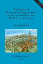
  • av Charmian Woodfield
    1 255,-

    Excavations carried out in the 1960s on the site of the Carmelite Friary at Coventry, England, revealed the lost church, of unexpected size and splendour, adjoining the standing cloister E range. It was founded in 1342 by Sir John Poulteney, a pre-eminent merchant and Draper, and Lord Mayor of London. The report includes the first detailed examination of the standing E claustral range by the Royal Commission on Historic Monuments, probably the finest medieval friary claustral range to survive in N Europe. This is augmented by historical illustrations, many here published for the first time. There is also a study of the exceptionally fine surviving choir stalls, with the arms of several later London mayors, which originally seated up to 90 friars. These were set above acoustic chambers in the choir to amplify their singing. Only three other sets of friary choir stalls are known to exist in Britain. An attempt is made to reconstruct the appearance of the friary in its 10 acre (c.4ha) precinct in the 15th century, including the highly unusual architectural expression of the chapter house; the reredorter and the gate houses. Comparative plans of other Carmelite houses in Britain and Europe are illustrated for comparison, some for the first time.With contributions by Chris Caple, John Cattell, Geof Egan, Helen Howard, Philip Kiberd, Helen List, Graham Morgan, James Rackham, Stephanie Ratkai, Charles Tracy, Hugh Willmott and Paul Woodfield

  • av Alison McDonald
    755,-

    This volume, on a delightful area within sight of the towers and spires of central Oxford, is the result of 25 years work by the author. It began as a desk study which generated sufficient interest for the author to work on a base-line botanical survey of Port Meadow with Wolvercote Common, ancient pasture, and to contrast it with a similar survey of Picksey Mead, ancient hay-meadow. The historical research was extended to look at the history of the management of both these flood-plain areas in order to understand something of the differences in their species-composition and to enable the author to relate them to their past management. The pioneering environmental archaeology undertaken in the area is now an authoritative discipline and the ground-breaking use of a multi-disciplinary approach to grassland studies is at last being recognised by Natural England and others as an essential element in management plans for Sites of Special Scientific Interest. Since the early 1980s grants have been available for increasingly in-depth studies of a single topic. The publication of this volume represents a change of view in which multi-disciplinary studies, especially those relating to the history of man and the landscape he has influenced are recognized for the breadth of vision which is their strength. The description of the vegetation has proved invaluable when working with English Nature (now Natural England) over the intervening years as it provided a base-line from which natural and man-made changes in the vegetation could be measured. In particular, the description of Port Meadow Marsh was vital in connection with the study of Apium repens carried out by the Rare Plants Group of the Ashmolean Natural History Society of Oxfordshire for English Nature from 1996-2006. The author has brought the descriptions of the various communities into line with the relevant volumes of John Rodwell's British Plant Communities. The historical sections of the work have also stood the test of time and have been brought up to date where necessary and incorporated into this new volume. With the current interest in flood-alleviation plans for West Oxford, which include the possibility of constructing new channels associated with overflow areas within the river Thames flood-plain above Oxford, which could affect the hydrology and therefore the vegetation of these ancient pastures and meads, publication of this work is timely.

  • av Michael Klemperer
    2 029,-

    This work is a contribution to the body of 'new' landscape history drawing on a range of sources from archives, such as documents and maps, from archaeological excavation and from field survey in relation to the Doncaster district of South Yorkshire (UK). Rather than a focus on well-known national examples this study follows the lead established by authors whose studies examine developments in large-scale ornamental landscapes within a distinct geographical region. By taking a regional perspective, a systematic approach to survey can be adopted which enables coverage of sites throughout the social strata of the land-owning classes. Furthermore it allows parity in terms of any vernacular idiosyncrasies in social structure, economy and geography, which a countrywide survey would not allow. Following the introduction, the second chapter sets out these landscapes and the people who created them. This is done initially on a national scale, but then becomes focussed on the regional context in which the study sites are situated. The third chapter defines the methodology and the scale of analysis by which this survey is undertaken. The survey then uses four sites of the gentry as detailed case studies to examine the development of large-scale ornamental landscapes in the period c.1680-c.1840, placing them within a local and national framework. The chapters on context and the primary survey sites are elucidated with reference to a gazetteer of 57 survey sites within the study district. By using this device, which is included as an appendix to this work, a systematic approach to the study of designed landscapes within a regional context can be adopted. Furthermore, the gazetteer is intended to provide a resource for researchers wishing to undertake further investigation into the ornamental landscapes of the Doncaster area. In the final chapter comparisons are drawn between the development of designed landscapes, in a regional context, in relation to the models provided by art historical and contextual texts on the subject.

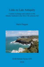
  • - Ceramic exchange and contacts on the Atlantic Seaboard in the 5th to 7th centuries AD
    av Maria Duggan
    1 035,-

    This publication began as an AHRC-funded doctoral thesis, 'Links to Late Antiquity: Understanding Contacts on the Western Seaboard in the 5th to 7th Centuries', completed at Newcastle University in 2016. This revised version presents a broad-scale discussion of the evidence for contacts and connections in the Atlantic Seaboard region, based principally on ceramics. It extends knowledge of a category of material with a long history of scholarship in Britain and Ireland: amphorae and fineware vessels of East Mediterranean origin. The presence of this imported pottery at sites in western Britain, such as Tintagel in Cornwall, has frequently been used to suggest direct links between post-Roman Britain and the Byzantine World. This work offers an alternative position - that the wares reflect active and evolving networks of trans-shipment and exchange operating in the Atlantic Seaboard region between the fifth and seventh century. This first examination of parallel French, Spanish and Portuguese publications provides a fresh perspective on this important group of artefacts for understanding early medieval Britain.

  • - A definition of Iron Age communities within the Dorset environs
    av Martin Papworth
    1 775,-

    Ptolemy's second century geography is the main source traditionally used when dividing pre-Roman Britain into tribal areas. In it he describes the Durotriges as inhabiting Dorset and parts of Somerset, Wiltshire and Hampshire.

  • - Historical and archaeological evidence for the effect of the New Poor Law on the health and diet of London's post-medieval poor
    av Brittney K. Shields Wilford
    539,-

    Adopting a multidisciplinary approach, this work presents an integration of osteological and historical evidence to examine the detrimental impact of the workhouse on inmates in nineteenth-century London and to assess whether the 1834 change to the English Poor Laws led to deterioration in health. Due to the new legalities of the New Poor Laws, reformers sought to create a nationalised system of welfare, which culminated in the establishment of the Union workhouse. All aspects of daily life were influenced within the institution, in an attempt to instil the 'virtues of the independent labourer'. It is hypothesised that the effects of the New Poor law would have exposed inmates to episodes of dietary deficiencies and infectious disease, detectable in the osteological record. This was investigated utilising published osteological data for five Post-Medieval London cemeteries and four associated historical registers of burials.

  • - Guildhalls in York, c. 1350-1630
    av Katherine Giles
    1 749,-

    Based on her Doctoral research, Katherine Giles's study focuses on the physical structure and spatial arrangement of medieval guildhalls.

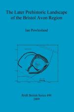
  • av Ian Powlesland
    1 019,-

    This work was inspired by research undertaken during a field survey of the later prehistoric remains of north-east Somerset (SW England) which showed that there were many cropmark sites of which little was known. The value of this evidence for the interpretation of prehistoric landscapes has been highlighted by a number of reports in recent decades. Across the country these surveys have added new dimensions to our understanding of prehistoric settlement patterns and the central role of aerial survey in elucidating these lost landscapes. The Bristol Avon Region had not previously been a primary research objective, as it lies outside the main concentration of known cropmarks. By collating the evidence from aerial photographs alongside that for previously recorded earthworks and excavations, then earlier hypotheses about this later prehistoric landscape could be re-evaluated. By taking the watershed of the Bristol Avon River as a whole it was hoped that regional differences in settlement morphology could also be identified to test these earlier hypotheses.

  • - Sabbatarianism in English medieval wall painting
    av Athene Reiss
    939,-

    This study takes as its subject a striking image found in fifteenth-century churches, paintings whose purpose is to warn the faithful of the consequences of working on Sundays. This detailed study of pictures of Christ, surrounded and wounded by the tools of everyday trades used on holy days, offers an in-depth exploration of a theologically complex subject. It illuminates many aspects of the functioning of late medieval devotion and the active role imagery could play in the formation and practice of devotional morality and communal identity. The medium of wall painting receives overdue attention as an arena of medieval artistic production and is shown to be the site of pictorial innovation and parochial expression.

  • av Thomas Finan
    599,-

    This study investigates the nation and nationalism, national ideology, and national identity in Ireland during the thirteenth and fourteenth centuries. The study aims to explore whether such terms as "nation "or "nationalism " may be applied to medieval Ireland. While many historians and sociologists argue that the nation may exist only in the modern world with the advent of the nation-state, others have shown that, at least, ethnic groups which appear to be nations existed in medieval Europe, possibly in antiquity. In Ireland, historiographical issues related to the creation of the modern Irish state in the early twentieth century have always guided the study of the nation and nationalism. The central questions addressed include whether there are observable manifestations of a nation, national identity, and ethnically-based ideology in Gaelic Ireland in the years 1200-1400, and the extent to which those manifestations may accurately be described in national terms. In this study, the nation shall be defined as a population sharing an ethnic history, tradition, language, and/or religion, and this population's connection with a particular, definable geographic region. In addition, this identity will be shown as often conflicting with the self-ascribed identity of another population sharing the same or neighboring geographic space. Hence, examples of a nation found in medieval Ireland will embody the double characteristics of being a means of self-identity for the Irish and of self-distinction from the Anglo-Normans.

  • - Excavations in the extra-mural area: The Parks 1998, London Road 1997-8, and other investigations
     
    1 035,-

    Birmingham University Field Archaeology Unit - Monograph Series 6This volume presents the results from two excavations in the extra-mural area of Roman Godmanchester. Excavation at the Parks, to the north of the Roman town, was undertaken during 1998 in advance of a housing development, providing an opportunity to examine a large area flanking a Roman road. Important evidence for early Romano-British land-division and pottery production, mainly in the 2nd to 3rd centuries, was recorded. The most significant discovery was of a cemetery, probably dating to the 4th century, containing 62 largely well-preserved individuals. Excavation at London Road, to the south of Roman Godmanchester, was undertaken in two stages during 1997 and 1998, in advance of a school development, and investigated an area to the rear of the Ermine Street frontage. In addition to evidence of early-prehistoric activity, the excavation identified a sequence of Romano-British ditch-defined enclosures, a timber-framed building, and evidence for industrial activity and livestock herding or ranching. The results of other, smaller-scale investigations, at Chord Business Park, to the south of the Roman town, and at West Street, within the Roman town, are also summarised.

  • - New work and thought on cultural landscapes
    av Olivia Lelong & Emma Carver
    695,-

    This volume emerged from a conference held in Glasgow in October 2001, organised by Scottish Archaeological Forum. The study of cultural landscapes is growing increasingly more sophisticated in terms of technology and method, but also in terms of the conceptual approaches and theoretical frameworks applied to that study. At the same time, landscape as a modern construct is becoming ever more complex, even contentious: who owns and manages land, for what purposes and to whose benefit? what defines wild land, how 'wild' were our landscapes in antiquity and to what extent should this perceived wildness be preserved? In Scotland, in particular, issues of land reform have come to the fore in recent years, with crofters contesting the right to buy land and the recent establishment of the first national parks. Needs for economic sustainability are often at odds with the interests of heritage management and conservation. The 15 contributions to this volume are divided into four sections: Landscapes, Seascapes, The Management of Landscapes, and Approaches to Interpretation. The first two sections showcase particular studies of archaeological landscapes and seascapes from a variety of perspectives, although a number of common themes emerge from the diverse studies.

  • av Tony Abramson
    1 159,-

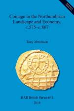
    This book presents the author's digitization of Pirie's substantial yet flawed corpus of 9th-century Northumbrian 'stycas'. This database, enhanced by data from elsewhere, is compared by location with the artefactual database known as VASLE (created at the University of York, 2008) to demonstrate that the co-occurrence of coins and portable artefacts defines monetary evolution in Northumbria. Additionally, the author presents a new periodization and reveals the previously disparaged gold shillings of York to have been issued by Bishop Paulinus, a disruptive finding chronologically, with wider consequences. Northumbria benefited increasingly, both monetarily and fiscally, as the face value of coins fell. Other conclusions include the idea that Northumbrian coin production was erratic; that the Yorkshire Wolds were more highly monetized than the surrounding lowlands, indicating a more enterprising culture; that styca hoards represent episcopal expropriations; and that there were significant changes in settlement and economy in the central lowlands. This work demonstrates that monetization reflected northern independence, innovation and enterprise.

  • - with a catalogue of the British engraved gems in The State Hermitage Museum
    av Julia Kagan
    2 029,-

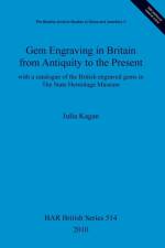
    The Beazley Archive Studies in Gems and Jewellery VDr. Julia Kagan, Curator of post-Classical engraved gems in the State Hermitage Museum in St. Petersburg, has devoted a lifetime of scholarship to the study of gem-engraving in Britain, in part inspired by the English Brown brothers who carved gems for Catherine the Great during the 18th century. The many articles she published in the 1960s and 1970s covering various aspects of the history of glyptics in Great Britain and the formation of the Hermitage's collection of British gems, an earlier dissertation which originally formed the basis of this book, and the attached catalogue, comprise a suitable tribute to the immense richness and diversity of gem engraving in Britain from Antiquity to the present. This comprehensive study includes a catalogue of the British engraved gems in The State Hermitage Museum, appendices of archive documents, and a table of British engravers.Translated (from Russian) by Catherine Phillips.Objects photographed by Leonard Heifitz, Svetlana Suetova and Leonid Volkov.

  • - Imperial Estates, metalla and the Roman military in the south east of Britain during the occupation
    av Simon Elliott
    789,-

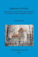
    Ragstone to Riches tells the story of the huge Roman metalla extractive industries of the south east of the province of Britannia. These provided much of the iron to equip the military there, and ragstone to facilitate the construction of the built environment in the region during the occupation, through to the middle of the 3rd century AD. In the former case this was the Wealden iron industry, which, especially to the north of Hastings, featured sites as large as any industrial enterprise today. Meanwhile, regarding the upper Medway Valley ragstone quarrying industry, the work identifies for the first time the five specific quarries which provided the material to build Roman London. For both, the author also explores the role played by the military in running these enormous metalla enterprises.

  • - Representations of the Human Figure in Funerary Contexts in Anglo-Saxon Art, AD 400-680
    av Lisa Brundle
    1 225,-

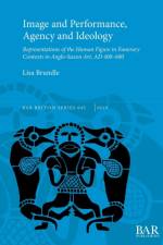
    This book investigates the topic of human imagery and hybrid human imagery rendered on metalwork of early Anglo-Saxon date recovered within eastern England (Cambridgeshire, Lincolnshire, Suffolk and Norfolk), AD 400-680. It presents the first definitive catalogue of its kind for this region and timeframe. Taking inspiration from recent transitions in thinking on early medieval mortuary archaeology and art, the author considers such topics as the interrelationship between image, object and the user, the changing portrayal of human representation and the social implications of such developments and the emergence of new bodily gestures in representational art. These key themes may provide an understanding of how and why human imagery changed as it did, how and by whom it was deployed in life and death and the role that this type of imagery performed in the construction and presentation of social identity.

  • - The archaeology of the A34/M4 Road Junction Improvement
    av Andrew Mudd
    505,-

    This report describes the results of the evaluations and excavations of the new A34/M4 interchange at Chieveley, West Berksire, England, and discusses the combined evidence from superficial and subsurface finds. It is concluded that there was a significant intensification of activity in the area starting in the Middle Bronze Age following a sporadic earlier prehistoric presence. This continued into the Late Bronze Age. The lack of Iron Age material is noted and there seems to have been a re-intensification of occupation in the late Iron Age or early Roman periods. The few early-middle Saxon pits were divorced from a settlement context and remain enigmatic.With contributions from Alex Thorne, Jane Timby, Tora Hylton, Ian Meadows, Val Fryer, Rowena Gale and Karen Deighton

  • - A regional model of hominid behaviour during the Middle Pleistocene
    av Robert Hosfield
    1 129,-

    The book explores the potential of geographic information systems (GIS) techniques to reduce the difficulties encountered while dealing with vast lithic data from the British Lower and Middle Palaeolithic and support analysis and interpretation of all the available archaeological evidence. The topics discussed are spatial modelling of the industrial landscape and long-term modelling of hominid behaviour.

  • - The archaeology of Middle Saxon Lincolnshire and Hampshire compared
    av Katharina Ulmschneider
    829,-

    This book presents a study and comparison of the historical and archaeological records of Middle Saxon Lincolnshire and Hampshire in the period immediately following the conversion to Christianity to the reign of King Alfred (c.650-870). The work charts and compares, from an archaeological perspective, the political, social, and economic development of Lincolnshire and Hampshire throughout the Middle Saxon period. It is the first full-length study of this period to include metal-detector finds, and to illustrate the outstanding importance of this extensive and continuously growing new material. In fact, the book presents a plea for the recognition of metal-detected material and the outstanding value of these finds to the archaeology of the Middle Saxon period. Containing 31 detailed maps in colour, illustrating finds and features.

  • av Duncan Garrow
    795,-

    The aim of this study is to consider pits from the Neolithic and Early Bronze Age - not easily classified - in substantial detail, to address questions concerning the kinds of practices and places they represent.

  • - The Archaeology of the A1(M) Alconbury to Peterborough Road Scheme
    av Peter Ellis, Peter Leach, Gwilym Hughes, m.fl.
    675,-

    Birmingham University Field Archaeology Unit - Monograph Series 1Written by Peter Ellis, Gwilym Hughes, Peter Leach, Catharine Mould and Jon SterenbergDescribes the results of archaeological investigations at a number of sites undertaken by Birmingham University Field Archaeology Unit in 1996. New prehistoric sites were found along the length of the road corridor which, from Alconbury Hill to Norman Cross, coincides with Ermine Street. Here the major Roman road would have taken on additional importance where it skirted the fen edge. The book reports on a number of excavations along this section.

  • av Hana Lewis
    909,-

    UCL Institute of Archaeology PhD Series, Volume 1The research presented in this book advances scholarship on Anglo-Saxon non-elite rural settlements through the analysis of material culture. Forty-four non-elite sites and the high-status site of Staunch Meadow, occupied throughout the Anglo-Saxon period (c. 5th-11th centuries) and geographically representative of Anglo-Saxon settlement in England, were selected for study. Comparative analyses of the material culture assemblages and settlement data from these sites were evaluated from four main research perspectives: the archaeological contexts and distributional patterns of material culture at the sites; the range and character of material culture; patterns of material culture consumption; and material culture as evidence for the economic reach of rural settlements.

Gör som tusentals andra bokälskare

Prenumerera på vårt nyhetsbrev för att få fantastiska erbjudanden och inspiration för din nästa läsning.