Marknadens största urval
Snabb leverans

Atlaser och kartor

Vår planet är enorm och består av ett stort antal länder, till och med öar som vi ännu inte har utforskat. På denna sida vill vi ta med dig på en resa genom jordens olika platser och vad de heter. Kunskapen om planeten är fantastisk och kan möjligtvis ge dig några häftiga idéer som du kan diskutera med dina nära och kära. Skapa din egen resa, eller lär dig mer om planeten och lär känna länder som du förmodligen inte har hört talas om förut. Förutom kunskap om världen och de många vägarna finns det mycket läsmaterial för det historiska hjärtat. Kartläggningen av atlas genom tiderna och hur världen har sett ut förut! Hitta inspirationen till din nästa resa här hos oss.
Visa mer
Filter
Filter
Sortera efterSortera Populära
  • av Collins Maps
    215,-

    A paperback edition of this fully revised general reference atlas in the exciting Collins world atlas range. Highly detailed maps giving balanced worldwide coverage, beautifully illustrated thematic pages and thousands of facts and statistics.

  • av Ordnance Survey
    239,-

  • av Ordnance Survey
    189,-

  • av Collins Maps
    159,-

    Fully revised and updated reference atlas in the exciting Collins world atlas range. This atlas provides more mapping area than any other atlas at this price.

  • av Ordnance Survey
    189,-

    OS Explorer is the Ordnance Survey's most detailed map and is recommended for anyone enjoying outdoor activities such as walking, horse riding and off-road cycling. The series provides complete GB coverage and can now be used in all weathers thanks to OS Explorer - Active, a tough, versatile version of OS Explorer.

  • av Philip Parker
    349,-

    A beautful book for anyone interested in exploring the history of trade in maps. Trade is the lifeblood of nations. It has provided vital goods and wealth to countries and merchants from the ancient Egyptians who went in search of gold and ivory to their 21st-century equivalents trading high-tech electronic equipment from the Far East.

  • av Eric Newman
    465,-

  • - Giant Format, 600+ Pages: The #1 Global Reference, Complete & Unabridged - Vol. 1 of 3, Introduction, Maps, World, Afghanistan Gabon
    av Central Intelligence Agency
    489,-

    THE COMPREHENSIVE, RELIABLE, INDISPENSABLE GLOBAL REFERENCE WORK - FULLY UPDATED FOR 2020VOLUME 1 OF 3 - CONTAINS:Introduction: History of the Factbook, Guide to Country Profiles, Definitions and Notes, 39 Pages of Regional and World Reference Maps.Countries: World, Afghanistan to Gabon.For Volume 2, search for "1949117146".For Volume 3, search for "1949117154".Unique three-volume, large-format edition.Giant 8"x10" size - easy to read and navigate.New for 2020: expanded maps section - two-page world maps now each occupy three pages for greater detail.Complete & unabridged - 1,800+ pages total, 600+ pages per volume."Batteries last hours, books last decades. Get the print edition!"Looks AMAZING on any professional or home bookshelf!The World Factbook provides up-to-date information on the history, people, government, economy, geography, communications, transportation, military, and transnational issues for 267 world entities. This almanac-style reference work is created with input and data from numerous government departments, and is the single most accurate source of intelligence on the nations and peoples of our world.CREATED BY THE CIA, TRUSTED BY INTELLIGENCE OFFICERS, DIPLOMATS, ACADEMICS, JOURNALISTS AND OTHER PROFESSIONALS AROUND THE GLOBE.Sources include: Antarctic Information Program (National Science Foundation) - Armed Forces Medical Intelligence Center (Department of Defense) - Bureau of the Census (Department of Commerce) - Bureau of Labor Statistics (Department of Labor) - Council of Managers of National Antarctic Programs - Defense Intelligence Agency (Department of Defense) - Department of Energy - Department of State - Fish and Wildlife Service (Department of the Interior) - Maritime Administration (Department of Transportation) - National Geospatial-Intelligence Agency (Department of Defense) - Naval Facilities Engineering Command (Department of Defense) - Office of Insular Affairs (Department of the Interior) - Office of Naval Intelligence (Department of Defense) - Oil & Gas Journal - United States Board on Geographic Names (Department of the Interior) - United States Transportation Command (Department of Defense) - and more...Proudly Published in the U.S.A. by CARLILE MEDIA.

  • av Freytag & Berndt
    245,-

    Et sæt bestående af 2 vandrekort som samlet dækker alle øerne i Azorerne. Målestokken er 1:50.000. Turistinformationer på engelsk og tysk. Register med postnumre. Kortet er GPS-kompatibelt.

  • av Michelin
    117,-

    Hæftet miniatlas over den kendte pilgrims vandrerute i målestokken 1:150.000. Kortet dækker fra St-Jean-Pied-de-Port til Santiago de Compostela. Indeholder oversigt over herberger og refugier samt praktisk information.

  • av Freytag & Berndt
    176,-

    Falset landkort i målestokken 1:500.000. Kortet er indsat i et omslag sammen med et lille hæfte med 5 bykort og et stednavneregister med postnumre.

  • - Newtonmore - Buckie
     
    179,-

    The Speyside Way runs between between Aviemore and Buckie on the Moray Firth passing through some of Scotland's most beautiful landscapes. Printed on waterproof paper and in a durable slipcase it provides compact and concise information for walkers with new maps of the whole 87 mile (140km) route, based on OS data.

  • - Dark Peak Area
     
    189,-

    OS Explorer is the Ordnance Survey's most detailed map and is recommended for anyone enjoying outdoor activities like walking, horse riding and off-road cycling. The OS Explorer range of OL maps now includes a digital version of the paper map, accessed through the OS smartphone app, OS Maps.

  • av David Weller
    159,-

    West Sussex is a wonderfully diverse county and a joy to explore on foot. This collection of 20 circular walks, varying in length between 3 and 7 miles, takes in some of its finest countryside, coastline and woodland.

  • - The Classic Guide to the City
    av Hilary Sumner-Boyd
    285,-

    This classic guide to Istanbul by Hilary Summer-Boyd and John Freely - the 'best travel guide to Istanbul' ("The Times"), 'a guide book that reads like a novel' ("New York Times") - is here, for the first time since its original publication thirty-seven years ago, published in a completely revised and updated new edition. Taking the reader on foot through this captivating city - European City of Culture 2010 - the authors describe the historic monuments and sites of what was once Constantinople and the capital in turn of the Byzantine and Ottoman Empires, in the context of the great living city. Woven throughout are vivid anecdotes, secret histories, hidden gems and every major place of interest the traveler will want to see. Practical and informative, readable and vividly described, this is the definitive guide to and story of Istanbul, by those who know it best.

  • av Periplus Editors
    129,-

    Navigating the various regions during your trip to Thailand is a breeze with this handy Tuttle travel atlas. Designed for the adventurous traveler, and containing all the maps you'll need on your explorations, this atlas includes many views that are not available on other maps of Thailand.The atlas is conveniently divided into the major regions: Bangkok, Central Thailand, Southeastern Thailand, and Northern Thailand. Each of the 23 maps in this atlas is presented in a logical, easy-to-follow manner, with emphasis on the most frequently visited areas. All place names, street names and buildings are indexed for quick reference.COMPREHENSIVE: Detailed insets of major cities, travel destinations and business hubs in ThailandINFORMATIVE: Precise locations of all famous sights, restaurants, temples, shopping malls and other essential locationsPRACTICAL: The well-designed maps and comprehensive index help you find places you are looking for quicklyRELIABLE: The maps in this atlas are thoroughly researched and regularly updated by the leading publisher of Asia Pacific maps.

  • av Nick Channer
    189,-

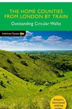
    New Pathfinder (R) walking guide for the home counties around London, featuring 28 circular walks ranging in length from 2 to 13 miles. All walking routes are easily accessible by train from London and accompanied by GPS waypoints, Ordnance Survey maps and beautiful photography.

  •  
    279,-

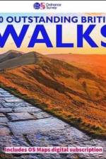
    100 Outstanding British Walks is lavishly illustrated with stunning landscape photography and informative introductions to each of the walks. It is designed to be enjoyed at home, while the OS Maps app provides the practical means to follow each of the routes in the great outdoors.

  •  
    111,-

    The OS Tour Map series is a must for anyone visiting Britain's most popular holiday destinations. These maps are packed with essential tourist information - from the best beaches to rural pubs, designed specifically with Tourists in mind.

  • av Jacob F. Field
    175,-

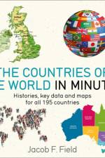
    All 195 countries illustrated and explained in an instant

  • - High peaks and classic climbs in Switzerland
    av Stephane Maire
    225,-

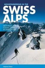
    Mountaineering in the Swiss Alps presents a selection of classic routes in the main climbing areas of Switzerland. Featured are over thirty climbs, including world famous peaks such as the Matterhorn (Mont Cervin) and the Monch. Written by Stephane Maire, each route features technical notes, a route description and topo, and stunning photos.

  • av Sue Viccars
    189,-

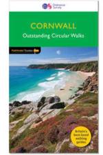
    New edition of the best-selling walking guide to Cornwall featuring 29 classic, circular walks giving access to Britain's finest coastal scenery. Also featuring a new walk exploring the ancient landscape of Bodmin Moor. All routes are accompanied by GPS waypoints, Ordnance Survey maps and colour photography.

  • av John Brooks
    189,-

    28 circular, graded walks all tried and tested by seasoned walkers. The routes range from extended strolls to exhilarating hikes, so there is something for everyone.

  • av Dennis Kelsall
    189,-

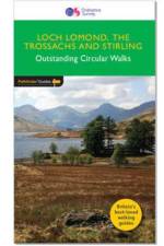
    28 fabulous country walks in the Stirling vicinity and the Loch Lomond National Park. Graded by length and ranging from 2 to 16 miles, all routes come with a clear, large-scale OS map, GPS waypoints and highlight where to park, good pubs and places of interest en route.

  • - 25 classic mountain routes
    av Francois Laurens
    199,-

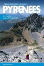
    Mountaineering in the Pyrenees by Francois Laurens features 25 classic mountain routes and link-ups - many of them accessible from spring to autumn - along the entire Pyrenean chain. Featured peaks include Pic des Posets, Monte Perdido, and the Vignemale. Each route features technical notes, a topo and route description, and stunning photography.

  • - London's Underground History of Tube Station Names
    av David Hilliam
    165,-

    The names of the 300 or so underground stations are part of everyday life for Londoners, but we hardly ever question their history. This entertaining book delves into their origins, ensuring you never view your journey in the same way again.

  • - Conservation area
    av Veronica Roodt
    189,-

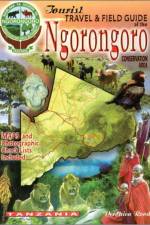
    Here is an all-in-one travellers' guide to one of the most extraordinary and beautiful places on Earth. It offers detailed maps, travel information and a photographic field guide in a single, handy volume.

  • - National park
    av Veronica Roodt
    175,99

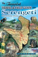
    This is an all-in-one travellers' guide to the Serengeti National Park - the vast, iconic reserve in the heart of East Africa. The book offers detailed maps, travel information and a photographic field guide in a single, handy volume.

Gör som tusentals andra bokälskare

Prenumerera på vårt nyhetsbrev för att få fantastiska erbjudanden och inspiration för din nästa läsning.