Marknadens största urval
Snabb leverans

Atlaser och kartor

Vår planet är enorm och består av ett stort antal länder, till och med öar som vi ännu inte har utforskat. På denna sida vill vi ta med dig på en resa genom jordens olika platser och vad de heter. Kunskapen om planeten är fantastisk och kan möjligtvis ge dig några häftiga idéer som du kan diskutera med dina nära och kära. Skapa din egen resa, eller lär dig mer om planeten och lär känna länder som du förmodligen inte har hört talas om förut. Förutom kunskap om världen och de många vägarna finns det mycket läsmaterial för det historiska hjärtat. Kartläggningen av atlas genom tiderna och hur världen har sett ut förut! Hitta inspirationen till din nästa resa här hos oss.
Visa mer
Filter
Filter
Sortera efterSortera Populära
  •  
    259,-

    This A4 format atlas has been revised and updated for 2025 containing up-to-date mapping from the experts at the AA in a giant 2.3 miles to 1 inch scale. Features include a large print place names and index, top 300 AA-Inspected caravan and camping sites and over 240 service areas along with a 6 page clear route planner map.

  • Spara 15%
     
    195,-

    This A3 format atlas has been revised and updated for 2025 containing up-to-date mapping from the experts at the AA in a giant 2.5 miles to 1 inch scale. Features include a large print place names and index, 72 city, town and port plans, top 300 AA-Inspected caravan and camping sites, over 1,800 golf courses and a 4 page route planner .

  • Spara 15%
     
    195,-

    This A3 format atlas has been revised and updated for 2025 containing up-to-date mapping from the experts at the AA in a giant 2.5 miles to 1 inch scale. Features include large print place names and index, 72 city, town and port plans, top 300 AA-Inspected caravan and camping sites, over 1,800 golf courses and a 4 page route planner .

  • av Al Churcher
    145,-

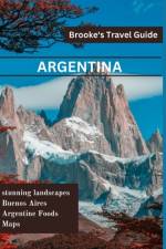
  • - Essential Travel Guide to Argentina
    av Cole Brooke
    189,-

    The Brooke's Travel Guide to Argentina is available to assist you whether you want to experience the tango in Buenos Aires, taste wine in Mendoza, or trek through Patagonia's glacial landscape.With the help of Brooke's Argentina Travel Guide, you can streamline the process of planning your trip and make the most of your time. This new edition has undergone a complete redesign with new content, an easy-to-read layout, and gorgeous color photos.In Brooke's travel guide to Argentina, you'll find: An illustrated guide to the best sights and activities is available at ULTIMATE EXPERIENCES.MANY ITINERARIES to efficiently plan your days and make the most of your time.MAP DETAILS to aid in confident navigation.COLOR PHOTOS all through to whet your appetite for travel!AUTHENTIC LOCAL RECOMMENDATIONS on the top attractions, eateries, lodging options, nightlife, activities, side trips, and more."The Best Outdoor Activities in Argentina," Additionally, "What to Eat and Drink in Argentina"TRIP-PLANNING TOOLS AND PRACTICAL TIPS, such as when to go, how to navigate, how to avoid crowds, and how to conserve time and money.A wealth of context on the local people, politics, art, architecture, food, dance, geography, and more is provided by historical and cultural insights.Iguaz Falls-specific features, Spanish language primer with helpful words and key phrasesCurrent coverage includes information on Buenos Aires, Igaz Falls, tango dancing, Patagonia, and more.Enjoy!

  • - Essential Guide To Rome
    av Cole Brooke
    179,-

    Whether you want to visit the Roman Forum, the Vatican, or the Colosseum, the Brooke's Travel Guide in Rome can help! It's jam-packed with maps, carefully curated recommendations, and everything else you need to streamline your trip planning and maximize your time. This new edition has been completely redesigned, with an easy-to-read layout, updated information, and stunning color photographs.Brooke's Rome travel guide includes the following items: MULTIPLE ITINERARIES TO EFFECTIVELY ORGANIZE YOUR DAYS AND MAXIMIZE YOUR TIME AN ILLUSTRATED ULTIMATE EXPERIENCES GUIDE TO THE TOP THINGS TO SEE AND DODETAILED MAPS to assist you in navigating confidently COLOR PHOTOS throughout to pique your wanderlust!BEST OF FEATURES WITH PHOTOS on Best Museums, Best Ancient Sites, Under the Radar Things to Do in Rome and more.TRIP-PLANNING TOOLS AND PRACTICAL TIPS, such as when to go, how to get around, how to avoid crowds, and how to save time and moneyCOVERAGE INCLUDES: Vatican City, the Roman Forum, the Colosseum, St. Peter's Basilica, the Pantheon, Trastevere, the Trevi Fountain, the Spanish Steps, and much more.

  • - Un Guide du touriste pour un voyage inoubliable
    av Léo Raphaël Pineda
    319,-

    Découvrez l'âme sauvage de l'Afrique avec "Namibie, Terre des Merveilles: Un Guide du touriste pour un voyage inoubliable" !Vous avez toujours rêvé d'explorer des paysages à couper le souffle, de vous plonger dans une culture riche et diversifiée, ou d'observer de près la faune sauvage en toute liberté ? Notre guide est votre billet pour une aventure namibienne inoubliable.Du désert du Namib, le plus ancien du monde, à la Côte des Squelettes, mystérieusement belle, en passant par le Parc National d'Etosha, un véritable éden pour les amoureux de la faune, nous vous emmenons bien au-delà des sentiers battus. Grâce à nos conseils pratiques, nos astuces de voyage et nos ressources supplémentaires, vous serez prêt à vivre le voyage de vos rêves en toute sérénité.Embarquez dans cette aventure captivante, découvrez la Namibie comme vous ne l'avez jamais vue et créez des souvenirs qui resteront gravés à jamais dans votre coeur.N'attendez plus, commandez dès maintenant ce guide et laissez-vous emporter dans l'extraordinaire voyage de votre vie.

  • - THE LAND OF TRULLI AND WINE: A Comprehensive Guide to Italy's Best-Kept Secret
    av James C Parker
    269,-

    Find the hidden gems of Puglia with TRAVEL PUGLIA comprehensive travel manual! Ideal for first-timers. This manual takes you off the beaten path and shows you the authentic, lesser-known side of this enchanting region. Immerse yourself in the rich history, culture, and cuisine of Puglia, from the enchanting ridge towns to the perfect beaches and everything in between. With insider tips, family travel tips, must-see sights, and dishes, TRAVEL PUGLIA will assist you in planning a definitive Puglia experience and making memories that last forever.Find out in this book vast information on accommodations, transportation, travel requirements, and lots on Puglia travel! "Ready to uncover the magic of Puglia and experience the genuine heart of Italy?Get your copy now and begin planning your unforgettable trip to Puglia!"

  • Spara 10%
    av Paulina Rowinska
    169 - 295

  • av Michelin
    169

    Michelin's France paperback A4 atlas offers, in addition of Michelin's clear and accurate mapping, an enhanced view of your journey thanks to its scale 1/200,000. The route planner as well as the time distance charts will help you plan and optimise journey. Michelin's safety alerts warn you about dangerous driving areas and zones subjet to tighter speed checks. Michelin's paperback France atlas also includes information on tourist sights, leisure facilities and scenic routes, as well as service areas to add pleasure and comfort to your journey.Michelin's France paperback tourist and motorist atlas features:- Scale 1/200,000: for an enhanced view of your journey- Key to map pages: to quickly access the region of your interest- A complete town index: To easily indentify to destination of your choice- Distance and time chart: to help you plan your trip- 6 major town plans: Paris, Bordeaux, Lille, Lyon, Marseille & Nantes- Michelin's danger alerts: to help you identify zones at risks for drivers and controlled speed areas- In English language: Keys, indexes and information- The atlas is also cross-referenced with the famous Michelin's Green Guide with tourist sights, scenic routes and leisure facilities.

  • av Michelin
    239,-

    This atlas is the perfect companion for an enjoyable and safe drive. Convenient and easy to use thanks to its spiral bound cover, this will provide you with precise and reliable information with its mapping scaled 1/150 000 for an enjoyable journey in Northern France, Belgium, Luxembourg and Netherlands. The route planner as well as the time and distance charts will help you plan and optimise your journey, whilst new location maps on top of each page as well as highly pratical street maps will ensure an easy navigation within the atlas. Tourist sights, leisure facilities and scenic routes will add pleasure to your journey.Mileage chart and journey times to help you plan your journey.Key to Map Pages to quickly access your region of interest.67 town plans for easy navigation in urban areas.An extensive place name index to easily identify the destination of your choice.Location maps on top of each pages for an easy navigation within the atlas.

  • av Michelin
    119,-

    Updated annually, MICHELIN National Map France Route Planning (map 726) will give you an overall picture of your journey thanks to its clear and accurate mapping scale 1/1 000 000. Our map will help you easily plan your safe and enjoyable journey in France thanks to a comprehensive key, a complete name index as well a clever time & distance chart. Michelin's driving information will help you navigate safely in all circumstances. In addition, MICHELIN National Map France Route Planning includes information on service stations and areas so that you can have enjoyable break during your journey! With MICHELIN National Maps, find more than just your way!MICHELIN NATIONAL MAPS feature:- Up-to-date mapping- A scale adapted to the size of the country- A clear and comprehensive key- Distance and time chart- Place name index- Driving and road safety information

  • av Michelin
    115

    MICHELIN zoom map Zoom Barcelona & Costa Brava is the ideal travel companion to fully explore this tourist destination thanks to its easy-to-use format and its scale of 1/150,000. In addition to Michelin's clear and accurate mapping, MICHELIN Zoom map highlights all the leisure activities available, such as golf clubs and tourist trains. MICHELIN Zoom Maps also include star-rated scenic routes, tourist sights & attractions, as well as camping sites and hotels selected in the famous MICHELIN guides. Make the most of your stay with MICHELIN Zoom Maps!MICHELIN ZOOM MAPS are perfect to discover major tourist areas, with a high level of details in an easy to use format. They nicely complement our Michelin Guides and include: - Various leisure activities, such as water parks, tourist trains, horse racing, etc- Scenic routes and tourist sights crossed referenced with the famous Michelin's Green Guides- Camping sites information from Michelin's Camping Guides- Hotel information from the world famous MICHELIN Guides

  • av Michelin
    119,-

    The MICHELIN Hautes Pyrenees, Pyrenees Atlantiques local map, scale 1/150,000 is the ideal companion to fully explore this northern part of France and provides star-rated Michelin tourist itineraries and attractions, as well as impressive 3D relief mapping. MICHELIN local maps are perfect for cyclist and outdoor enthusiasts with over 20 leisure symbols, extensive coverage of cycling paths and nature trails. With MICHELIN local maps, find more than just your way! - Impressive & realistic 3D relief mapping - Michelin selected itineraries and must-sees of the area - A clear and comprehensive key with 20 leisure symbols, as well as cycling paths and nature trails. - Star rated tourist sights and attractions cross referenced with the famous MICHELIN Green Guides. - Main cities plans and a comprehensive place name index

  • av Michelin
    119,-

    The MICHELIN Bouches du Rhone, Var local map, scale 1/150,000 is the ideal companion to fully explore this northern part of France and provides star-rated Michelin tourist itineraries and attractions, as well as impressive 3D relief mapping. MICHELIN local maps are perfect for cyclist and outdoor enthusiasts with over 20 leisure symbols, extensive coverage of cycling paths and nature trails. With MICHELIN local maps, find more than just your way! - Impressive & realistic 3D relief mapping - Michelin selected itineraries and must-sees of the area - A clear and comprehensive key with 20 leisure symbols, as well as cycling paths and nature trails. - Star rated tourist sights and attractions cross referenced with the famous MICHELIN Green Guides. - Main cities plans and a comprehensive place name index

  • av Michelin
    119,-

    The MICHELIN Allier, Puy de Dome local map, scale 1/150,000 is the ideal companion to fully explore this northern part of France and provides star-rated Michelin tourist itineraries and attractions, as well as impressive 3D relief mapping. MICHELIN local maps are perfect for cyclist and outdoor enthusiasts with over 20 leisure symbols, extensive coverage of cycling paths and nature trails. With MICHELIN local maps, find more than just your way! - Impressive & realistic 3D relief mapping - Michelin selected itineraries and must-sees of the area - A clear and comprehensive key with 20 leisure symbols, as well as cycling paths and nature trails. - Star rated tourist sights and attractions cross referenced with the famous MICHELIN Green Guides. - Main cities plans and a comprehensive place name index

  • av Michelin
    119,-

    The MICHELIN Charente, Charente Maritime local map, scale 1/150,000 is the ideal companion to fully explore this northern part of France and provides star-rated Michelin tourist itineraries and attractions, as well as impressive 3D relief mapping. MICHELIN local maps are perfect for cyclist and outdoor enthusiasts with over 20 leisure symbols, extensive coverage of cycling paths and nature trails. With MICHELIN local maps, find more than just your way! - Impressive & realistic 3D relief mapping - Michelin selected itineraries and must-sees of the area - A clear and comprehensive key with 20 leisure symbols, as well as cycling paths and nature trails. - Star rated tourist sights and attractions cross referenced with the famous MICHELIN Green Guides. - Main cities plans and a comprehensive place name index

  • av Michelin
    119,-

    The MICHELIN Bas Rhin, Haut Rhin, Territoire de Belfort local map, scale 1/150,000 is the ideal companion to fully explore this northern part of France and provides star-rated Michelin tourist itineraries and attractions, as well as impressive 3D relief mapping. MICHELIN local maps are perfect for cyclist and outdoor enthusiasts with over 20 leisure symbols, extensive coverage of cycling paths and nature trails. With MICHELIN local maps, find more than just your way! - Impressive & realistic 3D relief mapping - Michelin selected itineraries and must-sees of the area - A clear and comprehensive key with 20 leisure symbols, as well as cycling paths and nature trails. - Star rated tourist sights and attractions cross referenced with the famous MICHELIN Green Guides. - Main cities plans and a comprehensive place name index

  • av Michelin
    119,-

    The MICHELIN Aisne, Ardennes, Marne local map, scale 1/150,000 is the ideal companion to fully explore this northern part of France and provides star-rated Michelin tourist itineraries and attractions, as well as impressive 3D relief mapping. MICHELIN local maps are perfect for cyclist and outdoor enthusiasts with over 20 leisure symbols, extensive coverage of cycling paths and nature trails. With MICHELIN local maps, find more than just your way! - Impressive & realistic 3D relief mapping - Michelin selected itineraries and must-sees of the area - A clear and comprehensive key with 20 leisure symbols, as well as cycling paths and nature trails. - Star rated tourist sights and attractions cross referenced with the famous MICHELIN Green Guides. - Main cities plans and a comprehensive place name index

  • av Angela Quintal-Snowman
    645,-

    Ride where the adventure never ends!Adventure is calling as a new snowmobile season arrives in snow country! The Maine 2023-2024 Snowmobile Trail Atlas includes over 14,000 miles of groomed and backcountry snowmobile trails created from over 100 individual maps to show the most up-to-date and accurate trails possible! Discover new routes, plan scenic day rides, and epic multi-day adventures with the 2023-2024 Maine Snowmobile Trail Atlas. Now, you can plan the adventure of a lifetime for you and your crew!Unforgettable Rides and ExperiencesThe map shows ITS trails, snowmobile club trails, and ungroomed trails where you can lay first tracks after a fresh snowfall! Also included on the map are scenic and awesome hot spots and side trips like the Abandoned Locomotives, B-52 Crash Site, and Coburn Mountain Summit (the highest elevation you can reach by snowmobile in Maine). Now, you can plan ahead to see scenic views and unique landmarks instead of discovering them out on the trail when you're out of time! Maine's three legendary loop trails, the Moose Loop, Katahdin Loop, and Black Fly Loop, are clearly marked on the map for those who enjoy touring scenic and dynamic terrain. The Winter 2023-2024 edition includes marked trailer parking locations and fuel stops!2023-2024 Maine Snowmobile Trail Atlas Includes: ITS Primary Corridor TrailsITS Secondary Connector TrailsSnowmobile Club TrailsUngroomed TrailsLake Crossing TrailsTrail Route Numbers and NamesMore Detailed MapsGas StationsParking LocationsParts and Repair LocationsSnowmobile Club InformationMaine's Legendary Loop Trails: Moose LoopKatahdin Loop TrailBlack Fly LoopHot Spots and Side Trips: Grand FallsAbandoned LocomotivesCoburn Mountain (the highest elevation you can reach by snowmobile in Maine)Moxie FallsB-52 Crash SiteLow's Covered BridgeScenic OverlooksMany more remote historic sites and natural landmarks!Terrain Features & Elevations***PLEASE NOTE***These maps are intended for trip planning purposes only and are not for navigation. Maine's snowmobile trail routes can change daily due to weather conditions, logging operations, landowner requests, etc.Contact local snowmobile clubs for the most updated information on trail routes and closures.

  • av Aaron L Overton
    145,-

    The Military Grid Reference System (MGRS) is the standard use by all NATO military forces to locate any point on Earth down to one meter locations. This is called a "geocode" - a unique identifier for any location or object that is short and can be fairly easily read by humans.The MGRS coordinate system is a vital part of land navigation and location coordination during operations. However, information online about the system is not particularly easy to understand. This book is intended to provide both a broad explanation of MGRS, but also deeper detail on elements of MGRS that are not immediately obvious. It also explains some practical uses to assist with land navigation, like calculating distances and azimuths.

  • av Zoran Nikolic
    259,-

    An ideal gift for anyone with an intrigue for geographical curiosities.Defined as sovereign states with a very small population, land area, or both, microstates serve as fascinating case studies of geopolitical significance. This atlas explores the unique history, politics, and self-determination of the world's smallest states.

  • av Imray
    775,-

    A handy-sized A2 pack of charts covering the Kent and Sussex coasts.

  • av Philip's Maps
    199,-

    Ever wanted to explore Britain's finest National Parks, go surfing on the best beaches or follow the Pilgrims' Trail? Philip's RGS Outdoor Britain maps it all, from the majestic heights of the Scottish Highlands to the lush valleys of Wales and all the heritage and activities in between.

  • av C S Hammond & Company
    249 - 399,-

  • av Ordnance Survey Ireland
    169

Gör som tusentals andra bokälskare

Prenumerera på vårt nyhetsbrev för att få fantastiska erbjudanden och inspiration för din nästa läsning.